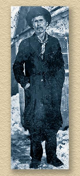
 Twenty-five-year-old Army Lt. Henry Allen stood in the Alaskan wilderness in 1885, staring up at the giant columns of frozen ice draping down from rapids of the Copper River. He was trying to see a path upward.
Little did he know that one day he would nearly surpass Meriwether Lewis and William Clark’s record of exploring and mapping virgin territory.
The Russians had already charted the Alaskan coast, but no one knew what laid beyond. Walls of ice in Alaska would not stop Lt. Allen.
After working at Fort Vancouver in Washington in 1884, Allen had transferred to Sitka, Alaska, to serve as the supply officer for the bloated Abercrombie Expedition. He boldly presented Gen. Nelson Miles a proposal: send a group of three to four men into the unknown.
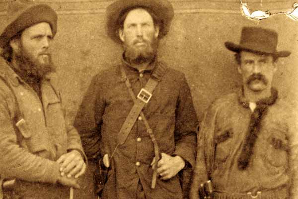
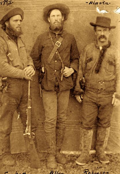
General Miles consented, and on March 19, 1885, Allen and his comrades—Sgt. Cady Robertson, Pvt. Frederick Fickett and guide Peder Johnson—ascended the Copper River into the blanks on the map.
Now that the four of them stood at the base of the frozen rapids, Allen ordered his men to drop half of their supplies. When they climbed to the top, they found two massive glaciers looming before them. Their only hope for food was finding the mysterious High Chief Nicolai of the Atnatana. They scaled the cliffs of Woods Canyon, trying to reach Taral. At the village, they found Johnson’s former partner, John Bremmer, who said he could lead them to Chief Nicolai.
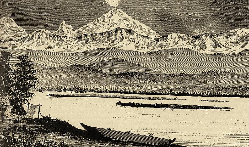
Bremmer located the chief’s village a week later, and Allen’s men dined there with copper forks and knives. Nicolai guided them to his copper mines within the previously unknown Wrangell Mountains. Allen recognized these as the most northern active volcanoes of the continent.
He now moved to find the source of the Copper River, but within a month, he and his men were again starving, trading for bits of wormy meat and rotted goose eggs. An elderly American Indian guided them into the Slana Valley, the source of the Copper. Just as they were about to perish, the streams became choked with salmon, saving their lives.
On June 9, Allen stood in a mountain pass of the Alaska Range. On one side, a trickle was the mighty Copper River and the other was the Tanana Basin, Alaska’s true interior. It was still daylight at 1:30 a.m. “On this pass…I sat proud of the grand sight which no visitor save an Atnatana or Tanana had ever seen,” reported Allen.
Allen had blazed a 1,500-mile trail into the very heart of Alaska, mapping three major river systems and locating passes through mountain ranges and vast mineral deposits. Allen’s map was the first to mention a mountain later called Mount McKinley.
Allen returned home, marrying Dora Johnston and fathering three children. The U.S. government was still using his maps when he died in 1930.
Mike Coppock is a published author of Alaskan history works. Do you know about an unsung character of the Old West whose story we should share here? Send the details to editor@twmag.com, and be sure to include high-resolution historical photos.
Photo Gallery
– Courtesy Fred Wildon Fickett Papers, Archives and Special Collections, Consortium Library, University of Alaska Anchorage –
– True West Archives –
– From Lt. Henry Allen’s report “The Copper, Tanana, and Koyukuk Rivers in the Territory of Alaska –
Related Articles
-
Henry Starr. Belle Starr. Just how were the two notorious folks related? The legends have…
-
The James-Younger Gang was trying to rob the First National Bank in Northfield, MN on…
-
In its heyday Tombstone was never wanting for good attorneys and none was more talented…