 To the Lakota, it was the Moonshell River; to the French explorers, La Rivière North Platte; to the Americans, the North Platte.
Whatever its name, a generation of dreamers followed the muddy river west through the Great Plains segment of the Oregon Trail.
Like all roads west, the Oregon Trail had lots of branches and offshoots, some so heavily used that they got their own names—such as the California Trail and the Mormon Trail.
But the main route meandered 2,000 miles from Independence, Missouri, to the Willamette Valley of Oregon, winding its way over plains, across rivers and through high mountain passes.
Mountain men blazed much of the trail in the 1820s and 1830s. The rush began in 1841, when 32 members of the Bidwell-Bartleson party reached Oregon.
A hundred people followed with Elijah White in 1842, then a thousand more with Marcus Whitman a year later.
And the floodgates were open.
As many as 400,000 people may have traveled part of the Oregon Trail, although only around 12,000 hardy souls are thought to have traversed its entire length.
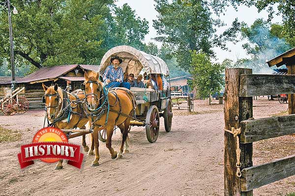
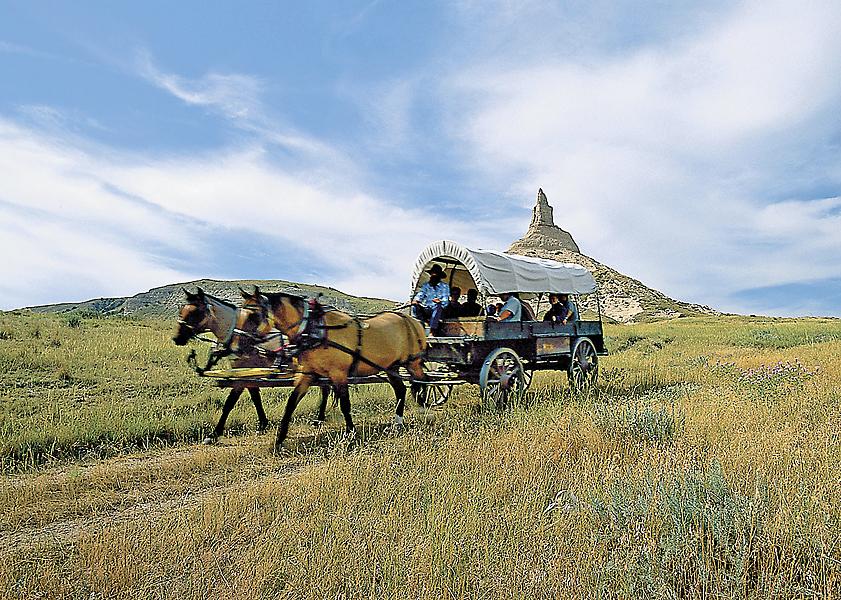
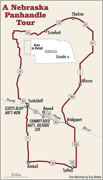
A loop drive through the Nebraska Panhandle takes you to a delightful variety of historic and natural attractions, including a couple of the most famous landmarks of the entire Oregon Trail.
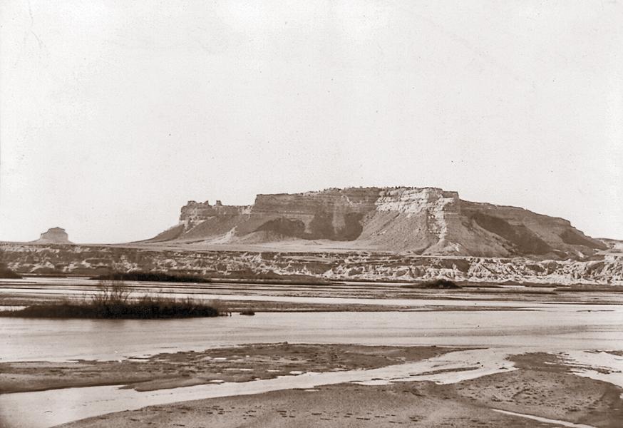
There’s no better place to start your tour than Scotts Bluff National Monument, named after one Hiram Scott, a fur trader who died nearby under somewhat murky circumstances in 1828.
The bluff, which stands more than 800 feet above the surrounding landscape, served notice to westbound travelers that before long they would be leaving the plains behind and facing the challenges of the Rocky Mountains.
Today it’s an easy drive to the top, where you can soak up stunning vistas as you try to imagine the life and hardships endured by those who passed below so many years ago.
The Oregon Trail Museum and Visitor Center provides a terrific overview of the area. Be sure to check out the paintings by William Henry Jackson, who traveled the Oregon-California Trail in 1866-67.
For a poignant reminder that not all emigrants survived the trip, stop by the gravesite of Mormon pioneer Rebecca Burdick Winters, who died of cholera in 1852 near Scottsbluff.
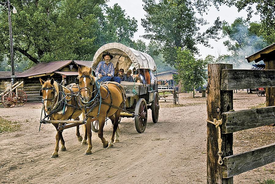
On your way to Scotts Bluff National Monument, look for the Farm and Ranch Museum (farm, get it?) just a mile west of Gering. The living history site was created to preserve and explain the agricultural heritage of the high plains.
In 2013, the Farm and Ranch Museum merged with the North Platte Valley Museum to become the Legacy of the Plains Museum, proof positive that a history museum by any other name would be as impressive.
At Scotts Bluff National Monument, there’s not much left of Fort Mitchell, which isn’t too surprising when you consider it was built of sod and adobe in 1864. The small fort was abandoned shortly after the Civil War ended in 1865, but not before soldiers stationed there fought with Sioux and Cheyenne warriors at Mud Springs. There’s a very cool scale model of the fort at the visitor center; visitation to the actual site is restricted.
A few miles west of Scottsbluff you’ll find the historic Horse Creek Treaty Grounds, where more than 10,000 Plains Indians—Sioux, Cheyenne, Arapaho, Crow, Arikara, Mandan, Shoshone, Gros Ventre and Assiniboine—gathered in 1851 to negotiate with the U.S. government. The result was the Treaty of Fort Laramie, intended to establish peace among the tribes, define each group’s territory and to formally allow the government to build roads through Indian territories in exchange for protection from settlers, prospectors and trappers.
Backtrack a few miles and turn north on Nebraska 29, which you take north to Harrison, where you turn east onto Highway 20 and head toward Crawford.
Just before reaching town you’ll come to Fort Robinson State Park, a don’t-miss stop on this journey. Nebraska’s largest state park (more than 22,000 acres) is as rich in history as it is in scenery.
Soldiers bayoneted Lakota Chief Crazy Horse here in 1877, after he had voluntarily returned to the fort to continue negotiations for his formal surrender. A monument at the fort marks the site of his death; the location of his grave remains a mystery.
Visitors today can stay in several of the fort’s original buildings.
Those hankering for a real cowboy experience should stop by the Ponderosa Ranch, about 10 miles south of Crawford. During the summer months you can ride fence lines or round up stray dogies at this working cattle ranch.
Continue your voyage across the prairie by heading east to Chadron to visit the Mari Sandoz High Plains Heritage Center, which honors one of Nebraska’s most beloved authors and the prairie life she wrote about so elegantly.
Just a few miles east of Chadron you’ll come to the Museum of the Fur Trade. In addition to information on trappers and traders, and an extraordinary collection of furs, the museum has more than 300 firearms made from 1640 to 1911, all designed for trappers to traders to Indians.
Don’t miss the Bordeaux Trading Post, reconstructed on the exact spot where the original (built in 1837) once stood.
For a taste of everyday life in the frontier panhandle, head south to Alliance and the Knight Museum and Sandhills Center, which houses a remarkable assortment of Indian artifacts and pioneer memorabilia.
The trip continues southward, across the North Platte River.
The Pony Express established a station at Mud Springs, a little northwest of Dalton, in 1860. A year later it became a telegraph station, which operated until 1876. There’s a monument at the site, but no buildings.
Continue south into Sidney and check out the original officers’ quarters and powder house at the Fort Sidney Complex. The museum is open summers only.
Next, drive west on U.S. 30 (the “Lincoln Highway,” the first transcontinental highway across the United States) to the Chamber of Commerce in Kimball, where you can pick up a map and driving directions to Panorama Point, the highest point in all Nebraska.
You can leave your rock climbing gear at home for your ascent of the point, which is little more than a bump in the surrounding pasture.
After your mountaineering adventure, return to Kimball and take Nebraska Highway 71 north back to Scottsbluff, completing your loop through history.
* For more great Western heritage travel adventures please click on the links below.
- On the Trail of Old Arizona
- Texas Hill Country Trail: Cavalry, Cowboys and Germans
- Following North Dakota’s Sheyenne River
- The Bozeman Trail
- On the California Trail: Salt Lake City to Sacramento
Photo Gallery
– Courtesy Nebraska Tourism –
– Courtesy Library of Congress –
– Courtesy Nebraska Tourism –
– Courtesy Library of Congress –
Related Articles
-
In the last decade, with the bicentennial of the Lewis and Clark Corps of Discovery…
-
Among the 12 outlaws featured in Outlaw Tales of Nebraska is James “Doc” Middleton Riley,…
-
I love state roadside guides and personally collect them. You’ll usually find mini-histories listed with…