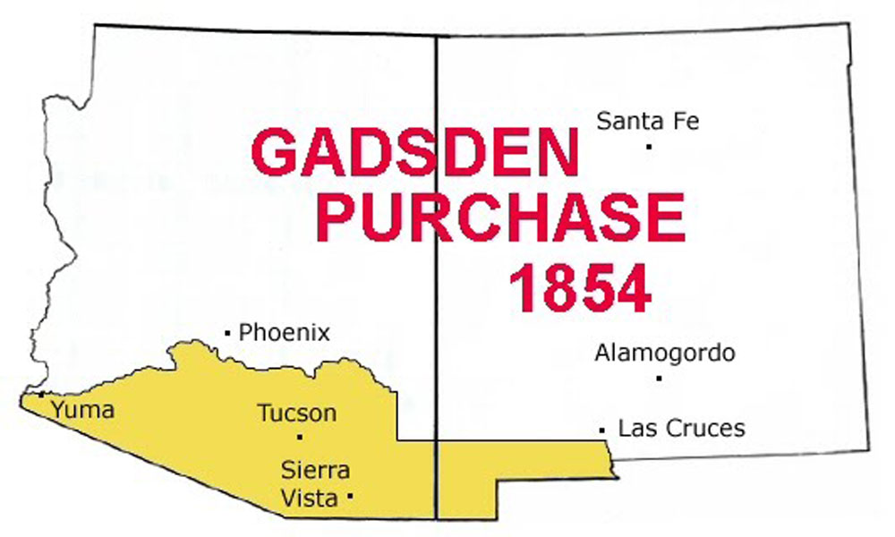

Following the Treaty of Guadalupe Hidalgo ending the Mexican War in 1848 the boundary line between the United States and Mexico in what would become the future Arizona was the Gila River.
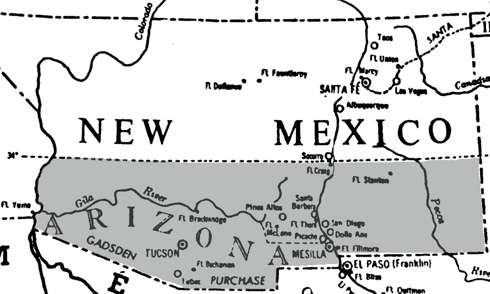
One of the reasons the U.S. wanted to acquire Arizona and New Mexico was to build a southern wagon road and a transcontinental railroad to California. However, the best place to build a road and lay tracks was further south of the Gila so a railroad man from South Carolina named James Gadsden was sent to Mexico to negotiate a land purchase that bears his name. The area included only three non-Indian communities, Mesilla, Tucson and Tubac. At the time it looked like the boundary line would run straight to the Sea of Cortez and the future Arizona would have a seaport but things didn’t work out that way.
James Gadsden was the son of Revolutionary War General Christopher Gadsden and the man for whom the Gadsden “Don’t Tread on Me” Flag is named. It was also an early motto of the Marine Corps.
Surveyors like straight lines and most boundary lines in the West are straight. For example, the northern boundary beelines from Oklahoma, New Mexico and Arizona to the eastern boundary of Nevada. So what about that diagonal line that prevent Arizona from having a seaport?
There’s an enduring legend that surveyors with the Army Corps of Topographical Engineers got drunk at a cantina in the village of Nogales and the next morning they asked the bartender for directions to the next saloon. He told them to go in a northwest direction to Yuma on the Colorado River. So, instead of following the straight line to the Sea of Cortez they marked a diagonal line to Yuma, thus depriving Arizona of a seaport.
It’s a good yarn but it ain’t true. First, there was no village of Nogales at the time and second the Republic of Mexico had no intention of giving up their land route to Baja California. So the diagonal line was part of the deal.
There was another reason too. The Southern states wanted to acquire more territory but the Northern states, fearing it would expand slavery, wanted to acquire just enough territory to build a wagon road and a railroad. Northern congressmen conspired with Juan Alamonte, the Mexican Minister in Washington, to limit the size of the land purchase. Alamonte’s skilled lobbying in Congress won the day.
Congress ratified the treaty on June 8th, 1854. For ten million dollars the U.S. added 29,670 square miles to the nation. It was the last land acquisition of the contiguous United States.
The wild and untamed country that lay between California and New Mexico was a dry, desolate, sun-baked land of jagged mountains and barren deserts was thought by many to be worthless. Even the legendary Kit Carson, who knew it well, declared so worthless “it wouldn’t feed a wolf.”
But those mountains bore a treasure trove of gold, silver and copper. It inspired one of the greatest mass migrations of greenhorns since the children of Israel set out in search of Canaan. Boom towns sprung up overnight. They boasted everything except a church and a jail. Towns were given picturesquely whimsical names like Tombstone, Total Wreck and Timbuctu.
Rumors abounded; “If ya stumble on a rock, don’t cuss it, cash it; Window curtains assayed out at 10 dollars to the ton after a dust storm; and if ya wash your face in the Hassayampa River ya could pan four ounces of gold dust from your whiskers.”
That ten million dollars turned out to be quite a bargain.
Related Articles
-
The reason Arizona doesn’t have a seaport on the Sea of Cortez is a…
-

Fleming “James” Parker was a career criminal, primarily a rustler, but in 1897, he took…
-

Whereas in some circles the unreliable narrator holds sway, Michael Zimmer’s latest book, Charlie Red:…