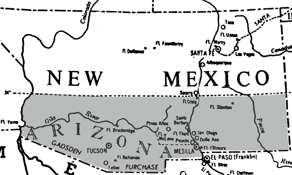

The reason Arizona doesn’t have a seaport on the Sea of Cortez is a persistent legend that just won’t go away. Looking at a map one sees a line heading west from Nogales that by rights should head straight to a seacoast. So what went wrong?
The legend goes that when the surveyors were marking the boundary when they paused to wet their whistles in a local cantina in Nogales. Before embarking on the next phase of their boundary survey they asked the bartender the location of the next saloon. He pointed to the northwest and replied, “Yuma.”
The next morning they made an executive decision and headed towards the next saloon at Yuma and that’s how Arizona got that strange diagonal line and no seaport.
The real story isn’t nearly as interesting as the tall tale. Truth is there wasn’t a Nogales at the time. Mexico didn’t want to lose their land route to Baja California and Northern congressmen didn’t want to see the South acquire more territory, so the two groups had enough clout to sell the U.S. just enough land to build an all-weather railroad line along the 32nd Parallel. The Civil War interrupted building a railroad until the 1870s. The Southern Pacific reached Tucson on March 20, 1880. Today Interstates 8 and 10 roughly follow the old Gila Trail across southern Arizona.
Related Articles
-

In 1888, New York illustrator extraordinaire Frederic Remington accompanied the 10th Cavalry Buffalo Soldiers in…
-

The U.S.-Mexico border has long been plagued by outlaws and bandidos from both sides of…
-
In 1898, Arizona became the first in the nation to sign up for a “cowboy…