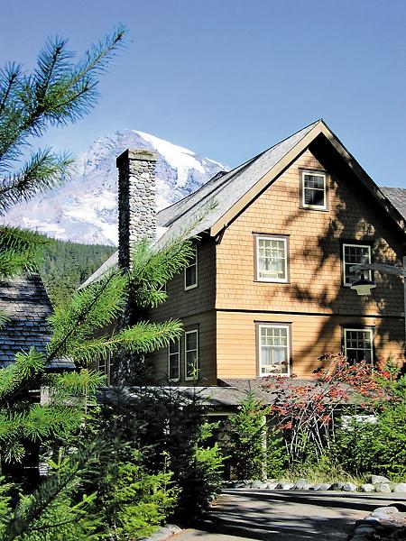
 Mount Rainier is the grande dame of Washington’s Cascade Mountains, visible from 150 miles in any direction. At 14,410 feet, this glacier-clad volcano is so big that she creates her own weather, yet so approachable that one million-plus visitors arrive each year to ski, hike or bask in the alpine environment.
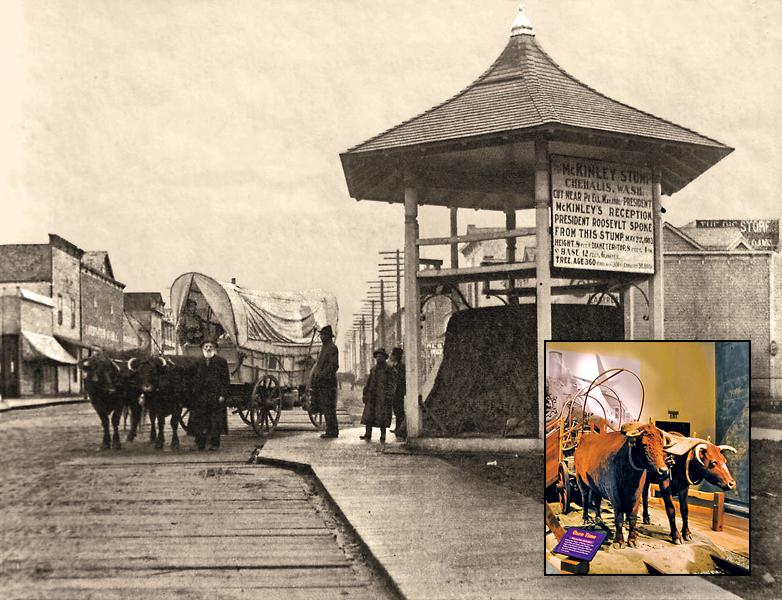
American Indians viewed Rainier as sacred, and they feared the spirit who lived at her summit. They gave her various names—Tahoma Takhoma or Ta-co-bet. In 1792, Capt. George Vancouver named the mountain in honor of Rear Admiral Peter Rainier of the British Royal Navy.
By the mid-1800s, a few pioneers had tried unsuccessfully to climb Rainier. Finally in 1870, Hazard Stevens, son of Washington’s first territorial governor, Philemon Beecher Van Trump, an unemployed miner, and Sluiskin, an Indian guide, tried the ascent. Sluiskin took the white men as far as the snowfields and discouraged them from climbing farther. However, Stevens and Van Trump persevered and reached the
summit safely.
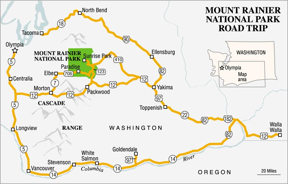
In 1899, the iconic Mount Rainier became the center point of the nation’s fifth national park, encompassing nearly 370 square miles of forests, flower-strewn meadows and sheer rock. In pioneer times, the mountain was surrounded by pack trails and wagon trails—many of these trails still exist and are now accessible by car. In fact, Rainier can be viewed as the hub of a wagon wheel, with a rim of encircling highways and many spokes leading to the center.
HIT THE ROAD IN TACOMA
Head northeast on Interstate 90 to North Bend, where you’ll find the west trailhead to Iron Horse State Park, a rails-to-trails endeavor accommodating horses and hikers, which is part of the John Wayne Pioneer Trail. Across Snoqualmie Pass, mosey into Ellensburg, which grew out of the 1870 trading post known as Robber’s Roost. The town is famous for its annual rodeo, where cowboys and cowgirls whoop it up each Labor Day weekend.
From Ellensburg, head to Yakima via Interstate 82 (part of the 1860s Old Cariboo Trail from British Columbia)—for a slower, more scenic route, take the parallel Route 821 through the Yakima River Canyon. Throughout eastern Washington, you’ll find a wealth of produce stands offering everything from apples to watermelons. The Yakima Valley Museum offers displays ranging from vibrant neon signs to a stunning collection of horse-drawn vehicles.
From Yakima, two routes lead to Mount Rainier. The northern route, Highway 410, follows a portion of the Naches Pass Trail over the Cascades; this trail was scouted in the early 1850s and offered Oregon Trail pioneers a more direct route to Puget Sound. The southern route, Highway 12, climbs to White Pass, a popular ski destination, and then enters the park at the Stevens Canyon Entrance.
Continuing along the rim of our wagon wheel, head south from Yakima to Toppenish. Along the way, visit the Yakama Nation Museum & Cultural Center to learn about tribal history. The Heritage Inn Restaurant offers traditional American Indian dishes; stay overnight in one of the tipis. The next day, detour west to Fort Simcoe State Park, where the rugged sagebrush landscape is punctuated by the remnants of a military fort built in the mid-1850s. Toppenish itself offers rodeos, Western-themed art shows and phenomenal outdoor murals depicting regional history.
LEWIS AND CLARK COUNTRY
Backtrack to the Columbia again, and head west on Route 14 where high basalt cliffs line the river. You’ll be amazed to see a replica of Stonehenge, built by railroad magnate Sam Hill as a memorial to WWI veterans. Hill also constructed the Maryhill Museum that exhibits wonderful European art and American Indian artifacts.
Goldendale, just a few miles north, boasts the Goldendale Observatory, one of the nation’s largest public telescopes. Drive several miles north to Satus Pass, and you may spot wild horses. West of town, stop at Horsethief Lake State Park to view Indian petroglyphs on the bluffs.
Several miles farther west, White Salmon marks the western end of the Columbia Gorge wine-growing area. Experience a white-water raft trip on the White Salmon River, then satisfy your hunger at Everybody’s Brewing pub and café.
Continue west on Route 14, stopping at the Columbia Gorge Interpretive Center near Stevenson to learn more about American Indian history and the gorge’s geology. The nearby Skamania Lodge offers a luxurious spa experience. Just downstream is Beacon Rock, an 848-foot basalt monolith landmark noted by Lewis and Clark. Today, adventurous souls can hike to the top for an eye-popping view of windsurfers on the river far below.
TRAILING FUR TRAPPERS
Once traveled by American Indians, fur trappers and pioneers, the 1845 Cowlitz Trail headed due north from Vancouver to connect the Columbia River to Puget Sound. Today’s Interstate 5 follows the same route and passes many historical landmarks along the way.
The territorial town of Monticello was established near the confluence of the Cowlitz and Columbia Rivers—it was washed away twice by floods before pioneers capitulated and moved upriver. The city of Longview was planned in the 1920s and contains a stately brick post office, library and the Hotel Monticello, with a must-see lobby full of gorgeous woodwork and historical murals.
Thirty miles north on Interstate 5, Lewis and Clark State Park is worth a short side trip. Although the famous explorers never got this far north, the park offers one of the last (and most accessible) lowland stands of old-growth forest. Here, you can turn east on U.S. Highway 12 and cruise into the Cascade foothills to Morton. Turn north to Elbe to ride the Mt. Rainier Scenic Railroad. Highway 706 leads to the Nisqually Entrance to Rainier. Alternatively, continue on Highway 12 through Packwood to the park’s Stevens Canyon Entrance.
RAINIER’S “RIM DRIVE”
Driving north again brings you to the southern tip of Puget Sound. Here, Tumwater Falls enticed pioneers to build a water-powered sawmill. Olympia became the territorial and then the state capital. Today, its waterfront offers a memorable walking experience, complete with viewing tower, picturesque marinas and locally famous seafood restaurants.
Heading back to Tacoma, visit the Lewis Army Museum and Fort Nisqually, another Hudson’s Bay Company post. From Olympia or Tacoma, scenic backroads will lead you to Route 7 and the Nisqually Entrance of Rainier.
Finally, you’ll get to Mount Rainier National Park itself. The southwest corner of the park was developed in the 1880s by the Longmire family who built a resort around a natural spring. Here, you’ll find the National Park Inn, general store, museum, an 1888 log cabin and two rock-encased mineral springs.
At the southeast corner of the park, the Ohanapecosh Visitor Center boasts a trail system that includes the Grove of the Patriarchs, a stunning section of old-growth giants draped with moss and lichens.
In the northeast corner, the official White River Entrance greets visitors on their way to Sunrise, the highest paved road in the park with a view of several glaciers.
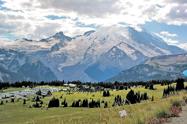
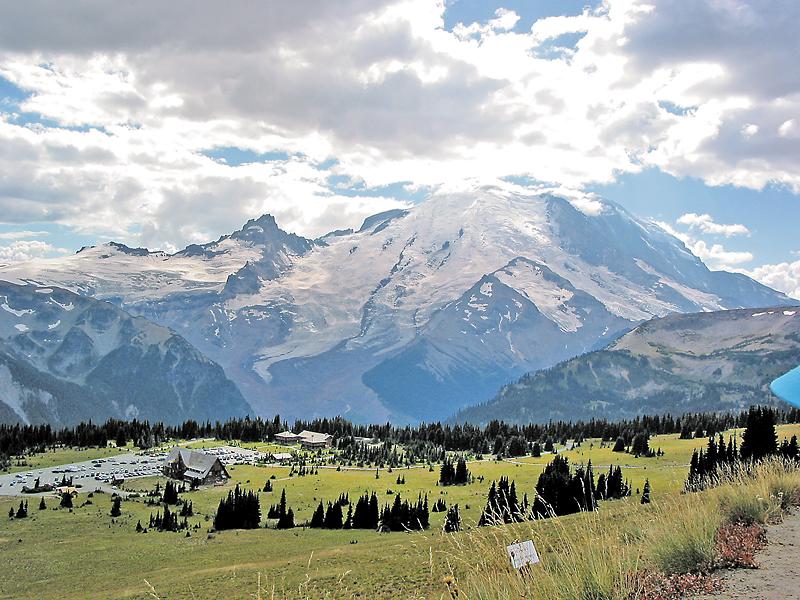
Eventually, all roads lead to Paradise. The park’s crown jewel is world-renowned for its wildflowers, breathtaking views of Rainier and the Tatoosh Range, the grand and historic Paradise Inn and miles of trails leading to fantastic overlooks. The Jackson Visitor Center offers a comprehensive interpretation of the mountain’s history.
Whichever road you take to Rainier, stop at Longmire’s National Park Inn at day’s end. Climb the steps to the generous veranda, ease into one of the oversized hickory chairs and prop your boots on the railing. Enjoy the peace as the setting sun casts a rosy alpenglow on the massive face of Washington’s highest mountain, the incomparable Rainier.
Photo Gallery
– True West Archives –
– Meeker: True West Archives; Museum: By Karen L. Johnson –
– By Karen L. Johnson –
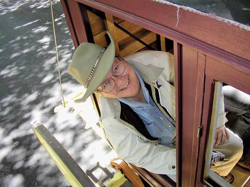
Karen L. Johnson
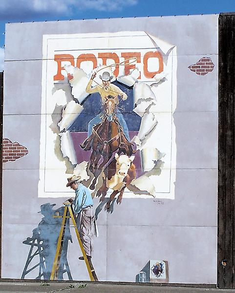
– Courtesy Toppenish Mural Society –
– By Karen L. Johnson –
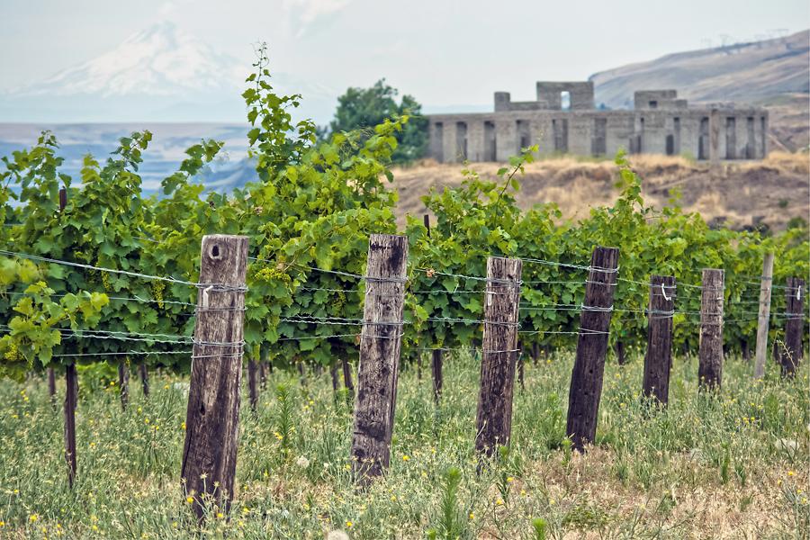
– Courtesy Seven of Hearts Wine –
Related Articles
-
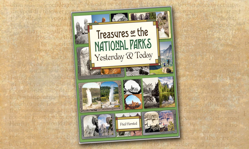
Treasures of the National Parks: Yesterday & Today (Golden Valley Press, $45) is a feast…
-
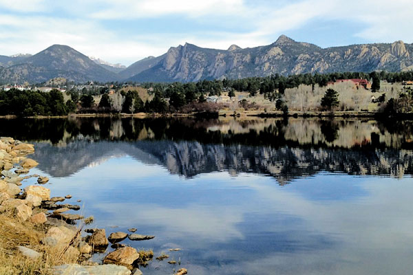
During Colorado’s gold “Rush to the Rockies,” Joel Estes was hunting with his son in…
-
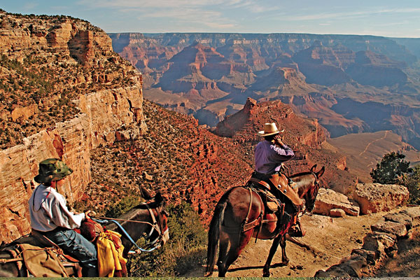
Arizona has more loops than a calf roper’s convention, and one of my favorites is…