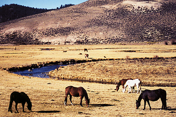
In one of his first acts as agent, Meeker relocated the White River Agency to a place known as Powell Meadow or Powell Bottom, named for Colorado River explorer John Wesley Powell. Meeker paid little heed to the fact that it was the area where the Utes grazed their horses and where they had a track for horse racing events. He started plowing the meadow in anticipation of planting crops. As if that wasn’t enough, he angered the Utes even more by suggesting they had too many horses and ought to kill some of them.
Meeker’s agrarian aims would fuel one of the West’s most violent Indian uprisings protesting reservation life.
No More Blue Sky
The Utes once roamed across most of Colorado and Utah, with some spending time in New Mexico, Arizona and Wyoming.
Known as Yutas, Utahs and Blue Sky People, the collective nation had divided into seven distinct bands by the late 1700s. The Utes raided into lands surrounding their homes, skirmishing with the other tribes. Yet they had few conflicts with outsiders.
The Uintah primarily lived in Utah’s Uintah Basin. The Yampa Utes occupied lands in the Yampa River Valley of northwest Colorado, while the Grand Utes made their homes along the Grand (later known as the Colorado) River. These bands became known as the Whiteriver Utes and along with the Uintah and Uncompahgre (formerly Tabeguache) bands, they make up the Northern Utes, who now live on the Uintah and Ouray Reservation in northeastern Utah, headquartered at Fort Duchesne.
The Capote and Mouache Utes lived in Colorado’s San Luis Valley, north central New Mexico and the Eastern Slope of Colorado, occasionally traveling and living as far south as Santa Fe. The Weeminuche Utes had territory in southwest Colorado along the San Juan, Las Animas, Mancos and La Plata river valleys. Those three bands, Capote, Mouache and Weeminuche (Ute Mountain Utes), comprise the Southern Ute nation with a reservation in southern Colorado and northern New Mexico, headquartered at Towaoc, Colorado.
By 1854, the Utes had recognized a graver enemy encroaching their territory. That year, the eastern bands participated in a raid on the new settlement at Pueblo, where we will begin our trip across some of the traditional Ute lands.
At the River’s Bend
In Pueblo, Colorado, I visit the re-created El Pueblo, an early trading center. The El Pueblo History Museum shares the story of the Ute raid in 1854 that drove out the original settlers. I stroll along the Historic Arkansas Riverwalk, once a lively scene of traders exchanging goods, and enjoy its park-like setting and tour boats on the river.
From Pueblo, my route is west along highway 50 through Canon City, where the road parallels the Arkansas River and skirts along the Royal Gorge of the Arkansas, a defile cut by eons of cascading water. The Royal Gorge is a thousand-foot canyon that can be viewed from above on the Royal Gorge Bridge, or from below by taking a ride on the Royal Gorge Railroad. But I stay on U.S. 50 to Salida and Poncha Springs, and then turn southwest along U.S. 285 to the small town of Saguache.
The Utes roamed this region until 1862, a year after the Colorado Territory was established, when tribal representatives met in Denver with Indian agent Lafayette Head, who ran the agency at Conejos. In Denver, the tribal representatives told Territorial Gov. John Evans they would live in harmony with the newly arriving settlers so long as the Utes could retain their own lands in Colorado and, by extension, in Utah. Subsequently, in the spring of 1863, a Ute contingent traveled to Washington, D.C., met with President Abraham Lincoln and ultimately ceded a portion of their lands, including the San Luis Valley and mountain areas where miners had already staked claims.
After the Ute Treaty in 1868 that established one reservation for all seven bands, the Utes had one agency on Los Pinos Creek some 50 miles northwest of Saguache on the west side of Cochetopa Pass, and another in northwest Colorado on the White River near the present-day town of Meeker.
Ouray’s Uncompahgre Utes
Despite the treaty, the Utes remained near Saguache and the agency on Los Pinos Creek until mining activity escalated in the San Juan Mountains to the west. This led to the Brunot Treaty of 1873 that further concentrated the Utes in the western part of Colorado Territory by closing Los Pinos Agency near Saguache and opening a new agency near present-day Montrose on the Uncompahgre River. This agency, known as Los Pinos II or the Uncompahgre Agency, led to a renaming of the Tabeguache band under leadership of Chief Ouray, which became known as the Uncompahgre Utes.
To follow the route the Utes took when they were moved from Los Pinos Agency to the Uncompahgre Agency, I drive along Colorado Highway 114 west from Saguache through ranch country to connect with U.S. 50 just east of Gunnison, and then continue west to Montrose.
Ouray is one of the most well known of the 19th-century Utes. He spoke Ute as well as fluent Spanish and English, a fact that enabled him to negotiate on behalf of his people. He died in 1880, a year before his people would be uprooted once again.
Land near the south edge of Montrose that once was a farm owned by Ouray and his wife Chipeta is owned by the State of Colorado and operated as the Ute Indian Museum. Chipeta is buried here and Ouray’s remains, which were initially interred in a cave south of Ignacio on the Southern Ute Reservation, have also been removed to this farm site.
Ute Mountain Utes
As part of the treaty negotiations in the 1860s-70s, the Ute bands were separated. I head south from Montrose on U.S. 550 over the San Juan Skyway and the Million Dollar Highway to Silverton, once the site of a Ute camp and later a silver mining boomtown, to Durango, then west on U.S. 160 to Cortez and southwest to Towaoc. Much of the route is over old Ute trails. By any measure, it is spectacular, with some of Colorado’s Fourteeners rising above the highway.
For a century, the Ute Mountain Ute tribe has occupied the land near Towaoc, in view of Sleeping Ute Mountain. Although you can visit the tribe’s casino, I avoid that attraction and instead go to the Ute Mountain pottery plant where workers make the distinctive pottery decorated with black-on-white designs.
Southeast of Towaoc is a private park, part of the Ute Mountain Ute Reservation, encompassing 125,000 acres that contains thousands of cliff dwellings and pueblo ruins that are some of the best preserved remains of Anasazi culture in this region even though they aren’t as well known as those of nearby Mesa Verde National Park. Ute guides can take you into the tribal park.
From Towaoc, I turn north back to Cortez and travel the western half of the San Juan Skyway by following Colorado highway 145 to Dolores, where I detour to visit the Anasazi Heritage Center with its incomparable collection of Indian artifacts. Back on the road, I head through Rico and over Lizard Head Pass to Telluride. I take Colorado route 62 from Placerville east to Ridgway where I complete the San Juan Skyway circle and head north to Montrose.
Whiteriver Utes
Having seen the agency sites and current reservation for the Tabeguache band and Southern Utes, I was now ready to enter traditional Northern Ute territory. Whiteriver Utes, one of the bands of Northern Utes, had claimed the area of Northwest Colorado for centuries.
From Montrose, I head north on U.S. 550 and U.S. 50 to Grand Junction, take I-70 east to Rifle and then Colorado highway 13 north to Meeker.
Meeker gets its name from the incident in 1879 that led to Ute tribal banishment from the region. Ranches spread in all directions from this small town, evidence that the goal of Indian Agent Nathan Meeker was grounded in sound agricultural principles. If Meeker had been more diplomatic in his relations with the Whiteriver Utes, perhaps the events of September 1879 would have played out differently; perhaps there wouldn’t be a town with his name on it.
Meeker became the Indian Agent for the White River Agency in Northwest Colorado in 1878 and promptly set out to run it like a communal agricultural enclave. The Utes, however, were hunters and gatherers, preferring to spend their time in search of big and small game animals rather than tending crops.
At the agency, Meeker was joined by his wife Arivella and daughter Josephine, and several other men who worked with him, including blacksmith E. Jasper Price who brought his wife Sophronia and their children Mae, age two, and John, who was not yet a year old.
As the summer of 1879 began, the Utes migrated from the reservation to engage in their annual hunting and foraging trips. Some headed as far north as Jack Creek in southern Wyoming where they “caught some elk calves which they wanted to trade for cartridges, but the ranchmen would not trade,” rancher Taylor Pennock wrote in July to Maj. Thomas Tipton Thornburgh, the commanding officer at Fort Fred Steele on the North Platte River. The ranchers did trade butter for the furs and skins, and Pennock wrote that the Utes “went south towards North Park [Colorado], between the 3rd and 5th of July, but did no damage nor made no threats.”
Back at the White River Agency, however, Meeker had escalating problems through the summer and into early fall as he attempted to turn the Utes from hunters into farmers. The Utes may have threatened him; almost certainly he overreacted. And then he asked for military troops to come to the reservation and intervene.
In late September, troops under Thornburgh’s command rode south from Fort Steele, eventually reaching Milk Creek, south of present-day Craig.
The route these troops took is roughly parallel to highway 13 from the Wyoming-Colorado border through Craig to Meeker. The troops crossed the Morapos Trail and took a route over Yellowjacket Pass, now accessible by following county roads between Craig and Meeker.
The soldiers and the Utes met in a field of battle September 29, 1879, south of Milk Creek Canyon. Thornburgh was killed and the soldiers soon found themselves surrounded by the tribesmen.
The military command could only defend itself, so that night, with many already dead and others wounded, four men mounted the strongest horses remaining and snuck through the guard line to seek help. Joe Rankin headed north into Wyoming, changing horses four times before reaching Rawlins and wiring Gen. George Crook in Omaha who ordered Gen. Wesley Merritt at Fort D.A. Russell near Cheyenne, Wyoming Territory, to relieve Thornburgh’s men.
John Gordon, another of the relief riders, contacted a courier from the Meeker Agency, who had been sent by Meeker to find Capt. Francis Dodge and the Ninth Cavalry. That party of Buffalo Soldiers had ridden north from New Mexico and was southeast of the agency, awaiting instructions about whether to move onto the reservation.
Made aware of the situation, by daybreak on October 2, Dodge neared the area where Thornburgh’s troops had been under siege since September 29. The relief soldiers forced their way into the soldier encampment but found they could not advance. Soon Dodge and his Buffalo Soldiers were as pinned down as Thornburgh’s troops had been. By noon of the second day after Dodge arrived, most of his cavalry horses were dead. Fortunately for the double group of besieged soldiers, Merritt had organized his relief column and began a forced march south from Rawlins toward Milk Creek.
Merritt reached the Milk Creek battleground before dawn on October 5. Upon his arrival, the Indians withdrew from their positions. Once the Utes retreated, the soldiers pushed on toward the agency, where they discovered the bodies of Meeker and several others. Arivella and Josephine Meeker and Sophronia Price and her two children had been taken captive. The women and children were held for 23 days before being released.
In response to the uprising, on June 8, 1880, the United States Senate ratified an agreement forcing relocation of the Northern Utes to a new reservation in Utah.
Following the Ute removal, White River Agency was abandoned. The military post metamorphosed into a town christened Meeker, incorporated in 1885. You can learn more about the agency and the area’s early settlement at the White River Museum.
Ute Reservations
Today the Utes are concentrated on two reservations: Ute Mountain Ute Reservation in southern Colorado and New Mexico, and the Uintah and Ouray Reservation in northeastern Utah.
From Craig, follow highway 40 to the Uintah and Ouray Reservation in Fort Duchesne, Utah. Then head south on highway 191 to Price.
Utes lived in Utah for centuries and evidence of their occupation is visible in pictographs through Nine Mile Canyon (which is actually 40 miles long) north of Price. The College of Eastern Utah Prehistoric Museum in Price not only provides information on how to visit that site but also offers displays of early Fremont people, the ancestors of the Utes.
Although most were forced from their traditional lands, the Utes retain their culture, which they share with visitors during annual powwows and other events, such as the Bear Dance celebration held each spring as a rite recognizing renewal.
Candy Moulton, a frequent contributor to True West, is the author of Roadside History of Colorado.


