
Through blowing snow, a pair of cowboys rode across the top of a mesa, searching for stray cattle.
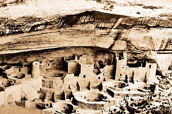
Quaker rancher Richard Wetherill and his brother-in-law Charlie Mason were not far from the family property below Mesa Verde in southwestern Colorado on December 18, 1888, when they spotted “the grandest view of all among the ancient ruins of the southwest,” as Mason described it. The cowboys entered the Anasazi dwelling, which would come to be known as Cliff Palace, and over the next 20 odd years, the two would lead exploration parties into Mesa Verde.
Accidental anthropologists, like Wetherill and Mason, often help us uncover some of the greatest secrets unrecorded by history. Many are still waiting to be found, and if you are alert enough, your name may be part of the next newsflash. Just look at the two college students, 21-year-old Will Thomas and 20-year-old Dave Deacy, who were wading along the western shore of the Columbia River in Kennewick, Washington, looking for a way to sneak into the annual Water Follies in 1996. Deacy hit his foot on something hard, picked it up and saw a skull staring back at him. The two hid the find in the bushes, went on to watch the highlight of the follies, the Columbia Cup hydroplane race, and then returned to their hiding spot and took the skull to the sheriff’s office. That skull turned out to be of the 9,000-year-old Kennewick Man.
Even if you never solve a mystery or reveal a hitherto unknown fact, you can at least relish in the discoveries of others and appreciate the lessons their finds have taught us. Shared here are little-known secrets of national parks across the West, uncovered by accidental anthropologists and studied experts.
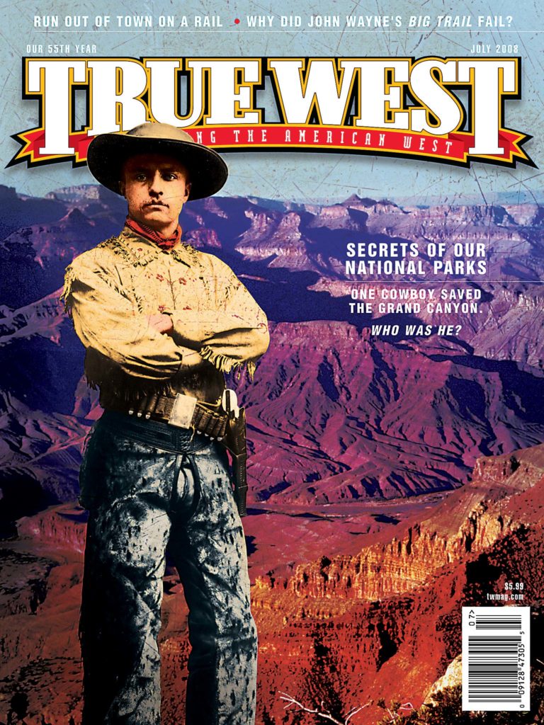
Teddy Roosevelt, our cover boy and iconic symbol of our nation’s storied national parks, once said, “It is an incalculable added pleasure to any one’s sum of happiness if he or she grows to know, even slightly or imperfectly, how to read and enjoy the wonder-book of nature.”
Enjoy the wonder-books of nature these passionate folks have left open for us to read.
Hot Springs, AR
Our Nation’s First National Park?
Since Hot Springs was set aside by Congress in 1832, some argue it is the oldest of the national parks, predating Yellowstone by 40 years.
Yellowstone, though, was the nation’s first federally managed park. When it was established in 1872, no state government could assume stewardship of the land, unlike Yosemite, which President Abe Lincoln protected back in 1864 and entrusted to the state of California (it became a national park in 1906). Since Yellowstone was part of the Wyoming Territory, the federal government took responsibility for the park.
Back in 1832, when President Andrew Jackson set aside the thermal springs of Hot Springs, Arkansas Territory, his signed legislation did not designate a party to take care of the reservation, just that it was reserved for the “future disposal of the United States.” Since federal control of the Hot Springs was not established until 1877, five years after Yellowstone’s status, some historians point to that date as when Hot Springs officially became a national park.
Of course, the National Park Service was not created until 1916, so none of these parks were “official” national parks until that year.
Whether it was Hot Springs or Yellowstone that was numero uno, we’re just happy we can still enjoy both special places.
Now if only we could see Old Faithful from the comfort of a thermal bath….
Sand Creek, CO
Finding Sand Creek
“The site of that historic [Sand Creek] affair has not been marked. If it were possible, we, as a nation, doubtless had rather the event could be forgotten,” stated Walter M. Camp, at an annual meeting for the Order of the Indian Wars of the U.S. on January 17, 1920.
For some of you lovers of Western history, the Sand Creek Massacre may seem to have long been a part of our national story. Yet the Sand Creek Massacre site was indeed one of our nation’s greatest secrets, and we were finally given the tools to pinpoint its location when Congress passed Sen. Ben Nighthorse Campbell’s act in 1998.
That year, the National Park Service, the State of Colorado and the Cheyenne and Arapaho tribes started working together to locate the massacre site. Jerome Greene and Douglas Scott recorded this story in their book, Finding Sand Creek: History, Archeology and the 1864 Massacre Site.
The lore confirmed the site was real, yet the physical proof was lacking, until that fateful May, 135 years after the massacre had taken place. Crews near the South Bend of Sand Creek pulled out of the soil shattered plates and hide scrapers belonging to the Cheyenne and Arapaho, and fragments of weapons that had been used to kill many of them on November 29, 1864.
That day came because the project’s leading historian Jerome Greene had combed through maps, diaries and firsthand accounts by Indians and the military. Based upon his research, he identified the massacre site as one mile north of the area most had thought was the site. When leading archaeologist Douglas Scott led his crew out there, they would ultimately uncover more than 400 material objects—the proof the National Park Service needed to affirm this was indeed the massacre site. As a result of this team study, Sand Creek gained status as a national historic site in 2000.
Although it took us more than a century to mark it, America has not forgotten Sand Creek, Mr. Camp.
Scotts Bluff, NE
Saving Yellowstone’s Savior
William Henry Jackson tramped around present-day Yellowstone, taking photographs of geysers and waterfalls that most had thought were tall tales.
He got the job thanks to his good work documenting reservation life in Omaha, Nebraska. Dr. Ferdinand Hayden hired him to photographically document the U.S. Geological Survey (USGS) of the Yellowstone River in Wyoming Territory in 1871-72. Jackson’s images of Yellowstone convinced Congress to set aside the area as our nation’s first national park in 1872.
Who’s saving the photographs and paintings created by Yellowstone’s savior? Scotts Bluff, which houses the world’s largest repository of works by Jackson.
He opened his first photographic studio in Omaha in 1869. He worked for the USGS, documenting not only Yellowstone but other places that eventually became national parks such as Mesa Verde and Yosemite, until 1878. Then he opened his photographic studio in Denver, Colorado.
Jackson exchanged his camera for a paintbrush at the age of 81, illustrating the West for books and magazine articles. From 1924 until his death in 1942, he finished nearly 100 paintings.
Many of his originals are on display at the park’s visitor center, but this year, you’re really in for a treat. Since the open house in February, the Visitor Center’s reading room is housing a changing exhibit highlighting Jackson’s work until all 65 original paintings and 519 original photographs at Scotts Bluff have been put on display. What a wonderful chance to see a collection that would usually stay hidden in storage because of lack of exhibit space.
When you see Jackson’s photographs of Yellowstone, don’t forget to silently say “Thank you.”
Canyonlands National Park, UT
Sphinx of Geology Solved
“Volcanic outburst!” “No, an eruption of salt!” “No, it was created by a meteor impact, I tell you!” Those strings of debate among geologists have finally come to pass, thanks to German researchers who just this year solved the mystery behind what created Upheaval Dome at Canyonlands National Park near Moab.
Elmar Buchner and Thomas Kenkmann published their findings in the March 2008 journal Geology , sharing their discovery of shocked quartz located off to the side of the crater. This clue settles the debate for once and for all: a meteorite caused the crater.
Crater Lake, OR
Man of the Lake
A century-old Man of the Lake?
Next time you make your way to this national park, look for a tall stump of tree that has been bobbing vertically in Oregon’s Crater Lake for more than a century.
When Joseph S. Diller published the first geology of Crater Lake in 1902 (the same year it became a national park), he noted that a stump he had found six years earlier appeared to be rooted near the west shore of Wizard Island. He first noticed it in 1896, when he tied it off with bailing wire to track its movement.
Given the caldera’s steep slopes, trees commonly slid into the water, roots first. How this particular one remained vertical can only be speculated. In John Salinas’s 1996 report for the National Park Service, he wrote how some believe the “Old Man” slipped into the lake with rocks bound within his roots. That would make him float vertically for the time being, and eventually the “submerged end could become heavier over time through being waterlogged. Acting like the wick on a candle, the shorter upper portion of the Old Man remains dry and light. This apparent equilibrium allows the log to be very stable in the water.”
However the 30-foot log got there, the bleached white Old Man still bobs four feet above the water. Unlike most who visit this park, when you see the Old Man, you’ll know its secret history.
Walla Walla, WA
Forgotten Grave at Whitman Mission?
Has anyone ever found the grave of the Whitmans’ only child?
National Park Service folks certainly searched for it, back in the late 1960s.
The story of the drowning of two-year-old Alice Clarissa would put tears in anyone’s eyes, as shared in the distraught mother’s letters sent home to her parents and sister.
The afternoon of June 23, 1839, Narcissa was settled into her reading, as Margaret McKay set the table for the evening meal. “Mama, supper is almost ready; let Alice get some water,” Narcissa recalled Alice saying to her. “This was like a shadow that passed across my mind,” she wrote, “[It] passed away and made no impression.”
With the meal ready, no one could find Alice, just two cups floating in the river. An image of Alice taking the cups with her flashed across Narcissa’s mind. She ran to the river; her husband Marcus behind her. Their daughter’s lifeless body floated by.
The grieving parents buried their only child in view of the Mission House, which Narcissa marked on a map she sent to her father. In 1847, a mass grave would hold the remains of Narcissa and Marcus, and others killed by local Indians during the massacre.
The search for Alice’s grave began in 1959, with the aid of the map, indicating that the grave was probably at the base of Shaft Hill, somewhere near the mass grave. National Park Service archaeologist Paul Schumacher found a grave in 1961, but it contained the body of an Indian.
In 1968, a marker dedicated to Alice was placed near the Indian’s grave site. Later that year, park ranger Larry Dodd found a letter written in 1888 by massacre survivor Matilda Sager, who placed Alice’s grave closer to the mass grave, “where the parents and their only child would lie side by side.” Even though the park service’s archival history of this finding indicates the marker should have been moved closer to the mass graves, it is still presently found in its 1968 location.
No matter all the conjecture about where Alice’s grave site may be, the reality is the location remains a mystery; to the best of our knowledge, no one has used modern-day tools to try to locate it.
Baby Alice exists today solely through her grieving mother’s letters. Narcissa’s words are all we need when we sit at the Whitman Mission, along the Walla Walla River, watching two cups float by in our minds.
Big Bend National Park, TX
Shopping for History
The convenience stores open year-round at Big Bend National Park in Texas include Chisos Basin, Rio Grande and Castolon.
None of those sound like anything out of the ordinary, but that last one, Castolon, is actually a historic trading post.
The store traces back to 1901, when Cipriano Hernandez opened the first store in the area, operating in what is known today as the Alvino House (Alvino Ybarra and his family moved into it in 1918, when it no longer housed the store). Hernandez sold it in 1914 to rancher Clyde Buttrill, who eventually moved it into a larger building, known today as Old Castolon. Then Howard Perry, owner of the Chisos Mining Company in nearby Terlingua, partnered up with Wayne Cartledge and bought the Castolon store in 1919. They called their enterprise La Harmonia Company, dealing mainly in trading furs, hides and skins until the 1940s.
In 1921, the owners moved La Harmonia to a new barracks building that the army built but never used, which is where you will find the store today. The National Park Service acquired La Harmonia’s holdings in 1961, and it operates the store today, albeit catering to tourists instead of area ranchers and miners, who left ages ago.
We think getting a dose of history with your groceries makes Castolon well worth the trip.
Nicodemus, KS
Exodusters’ Promised Land Out West
Dodge City and Wichita cowtowns. Forts Larned and Hays. The Mahaffie stage stop in Olathe. We know those Kansas sites, but how many of you have heard of Nicodemus, located an hour northwest of Hays?
Probably not too many, yet Angela Bates-Tompkins is doing as much as she can to spread her secret far and wide about the only remaining all-black town west of the Mississippi River today.
Two years before the “Black Exodus” of 1879 that welcomed the heaviest migration of slave refugees into free state Kansas, black minister Rev. W.H. Smith and white land promoter W.R. Hill founded Nicodemus. Their flyers encouraged southern blacks, mainly from Kentucky and Tennessee, to settle there.
Willina Hickman, one of the early Exodusters who built up this “promised land,” recalled her arrival in 1878: “When we got in sight of Nicodemus the men shouted, ‘There is Nicodemus!’ Being very sick, I hailed this news with gladness. I looked with all the eyes I had. I said, ‘Where is Nicodemus? I don’t see it.’ My husband pointed out various smokes coming out of the ground and said, ‘That is Nicodemus.’ The families lived in dugouts…. The scenery was not at all inviting, and I began to cry.”
Despite the incredible odds faced by settlers turning a desert sprinkled with stubby buffalo grass into an agricultural field of corn and wheat, Nicodemus survived. The town’s population has dwindled to about 40, but every July, many descendants of the original town settlers gather here to celebrate Emancipation Day.
Thanks to Angela, a descendant of settlers herself, five historic buildings, dating as far back as 1881, comprise the historic site maintained today by the park service. Since 1988, when she organized and served as the first president of the Nicodemus Historical Society, she has worked to preserve and interpret the town’s history, eventually earning a Lifetime Achievement Award in 2005.
While you visit the site, please respect the privacy of local residents.
Golden Gate NRA, CA
Spanish Presidio’s Hidden History
Many flock to El Polin Spring to watch birds such as the Townsend’s Warbler and the Dark-eyed Junco.
Yet the secrets of this spring were only unlocked recently, in 2003, a decade after Barbara Voss and other archaeologists had located the remains of the Spanish fort that defended San Francisco Bay from 1776 until 1846, when the U.S. Army took over the site.
Students picked away with shovels and dental picks outside of Spain’s northern-most outpost, El Presidio de San Francisco, at El Polin Spring, hoping to find an outlying building that would reveal how civilians interacted with local Californios.
When they struck greenish serpentine stone, they had hit pay dirt, noted Voss, an assistant professor of anthropology at the Stanford Archaeology Center.
They not only uncovered the site of pioneers linked to the founding of Yerba Buena, which became San Francisco, but they also learned that the military may have placed the civilians there to protect the water source. The foundation of the home had been built to military specifications, which discredits an earlier belief that families left the fort on their own.
The home they found is believed to be that of Marcos Briones and his three adult daughters, most notably Juana, who was one of the few Mexican women who purchased a land grant (she did not inherit it from her husband or other relative).
Given its important source of water, El Polin Springs may have been where San Francisco “began,” says Alison Stone, senior environmental planner for the Presidio Trust. If true, that’s certainly something to chirp about.
Lake Mead NRA, NV
Buried City Emerges
Set aside your wetsuit and Aqua Lung dive mask, St. Thomas, a Mormon settlement buried by Lake Mead that was once a scuba diver’s paradise, has come to the surface, possibly permanently, thanks to drought.
The confluence of the Virgin and Muddy Rivers attracted the Mormons here in 1865; a dam to control the fickle Colorado River put St. Thomas at the bottom of Lake Mead by 1938; and now the lake that supplies 90 percent of Las Vegas’s drinking water looks like it’s going dry.
The emergence of this buried city from the lake’s depths seems to support the conclusion of a report by the Scripps Institution of Oceanography in San Diego that Lake Mead could go dry in 13 years. Bureau of Reclamation officials have their own prediction—St. Thomas has emerged five times since it was abandoned, and water levels will rise to bury it once again.
No one is sure how this dry spell will play out. In the past, only the chimneys were visible when water levels dropped; this time, the entire town has surfaced.
Who knows if you’ll get a chance again to hike the ruins of St. Thomas, near Overton, so we recommend you get out there while you still can. Right now, you’ll see the remains of about 40 buildings, including the Hannig Ice Cream parlor and the two-story Gentry Hotel where, ironically, President Herbert Hoover stayed in 1932 before his namesake dam flooded the town.
Denali National Park, AK
Jurassic Park
I remember hiking in the desert near my high school in Arizona, looking for igneous and metamorphic rocks, as my geology teacher called out a list of rocks to collect: obsidian, basalt, rhyolite, slate, quartzite.
When I asked “Like this one?” I didn’t get quite the response Susi Tomsich did when she popped that question during her Department of Geology and Geophysics field camp on June 27, 2005.
Her professor, Dr. Paul McCarthy at the University of Alaska-Fairbanks, was rattling on about sedimentary rocks that preserved dinosaur tracks when she pointed out to him a six-inch wide, nine-inch long track that turned out to be a 70-million-year-old footprint of a three-toed Cretaceous period dinosaur.
Now that’s some rock!
Her discovery was the first evidence of dinosaurs found inside Denali National Park in Anchorage, Alaska. You can see this track at the Murie Science and Learning Center near the park’s entrance.
Since her finding, other tracks have been uncovered at the park, including those of theropods (meat-eating dinosaurs that walked on their hind legs) and hadrosaurs (duck-billed vegetarian dinosaurs).
Let’s hope nobody clones those bad boys out of amber-trapped DNA.
Little Bighorn Battlefield, MT
Cheyenne Suicide Boys
A surprising act by Cheyenne warriors, kept secret for nearly 100 years, finally got its due recognition. In 2005, John Doerner, chief historian at Little Bighorn Battlefield, placed the final markers commemorating the role the Cheyenne Suicide Boys had played during the June 25, 1876, battle.
The suicide pact actually first came to light in 1967, when Stands In Timber published the Cheyenne version of events after spending half a century gathering eyewitness accounts. His own grandfather had fought in the battle.
His book records four Northern Cheyennes—Little Whirlwind, Cut Belly, Closed Hand and Noisy Walking—taking a vow to fight until they died. The Cheyennes credited the Suicide Boys’ hand-to-hand combat charge into Custer’s column as the likely reason why Custer and his men fell, instead of surviving like many did at Reno Hill.
Since Little Whirlwind charged after Reno’s command from afar and was killed by an Arikara scout, his marker is placed at the Reno site. Noisy Walking and Closed Hand’s markers are placed between the Visitor Center and Last Stand Hill. Cut Belly’s marker is near Stone House, as that is where his wounded body was carried, only for him to die later.
Contrasting the white military gravestones, red granite headstones honoring each of the Suicide Boys bear the inscription: “A Cheyenne warrior fell here on June 25, 1876, while defending the Cheyenne way of life.”
And now you know…the rest of the story.
Chaco Canyon, NM
Anasazi’s Sun Dagger
In 1977, artist Anna Sofaer climbed up Fajada Butte to study the petroglyph art at Chaco Canyon. What she discovered caused a major shift in our understanding of the Anasazi who resided there until 1250 AD and their knowledge of astronomy.
She noticed that a beam of sunlight passing between two rocks bisected a spiral-shaped symbol on Summer Solstice. Curious if this “sun dagger” was indeed tracking the solar cycle, she returned to the site multiple times, noting the Winter Solstice was marked through a nearby rock, as were the Spring and Fall Equinoxes.
Her discovery led to a rethinking of what many had thought was a trade center; they noticed that the canyon is marked by 11 great houses seemingly oriented in solar, lunar and cardinal directions. Some researchers are shifting their earlier belief to the theory that Chaco Canyon was actually a center for ceremony.
Although we can no longer witness the Sun Dagger in action today (the rock slabs shifted in 1989), Anna’s story does demonstrate how alert park visitors can improve our understanding of our history.
When you visit your parks, enjoy them for all they offer but also keep your eyes open. Many great secrets remain inside our national parks.
Related Articles
-
Treasures of the National Parks: Yesterday & Today (Golden Valley Press, $45) is a feast…
-
I’ve always wanted to explore Bryce Canyon National Park. Recently, I was fortunate to be…
-
“A visit inspires love of country; begets contentment; engenders pride of possession; contains the antidote…