– Courtesy Fray Angélico Chávez History Library, New Mexico History Museum –
The smallest is just four inches by five-and-a-half inches, showing the Copernican Universe. The largest is 13 feet by 122 feet, showing railroad lines for the Elkhart and Santa Fe Railway in 1930.
Or how about the one that shows Santa Fe in Texas? Or California as a horizontal state, swallowing up what is now Arizona?
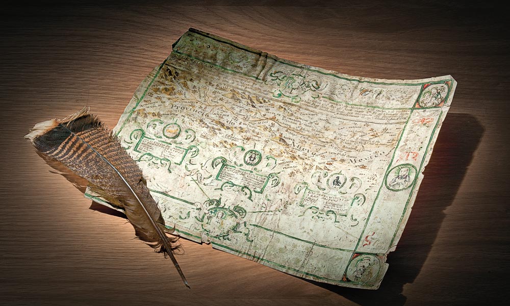
All are treasures at the Fray Angélico Chávez History Library in the Palace of the Governors in Santa Fe, New Mexico. They are among 6,000 maps cataloged over the last four years by the Historic New Mexico Maps project.
“Our maps are really historic,” says librarian Patricia Hewitt, who oversaw the project. “Some are lovely old maps. Some are fun maps. Some are cartoons. You can learn so much from them. I love the ones where you say, ‘Oh my god, that’s so wrong,’ because its not the way we see things today.”

“Most of our collection came through the Historical Society of New Mexico,” Hewitt explains. “They’re the oldest historical society west of the Mississippi and for years they were a collecting agency. Some maps were purchased. Some came from private donations. Sometimes people were cleaning out the garage and found a map
they brought to us—people don’t want to throw these things away.”
Who could throw away a reproduction of the “Plano dela villa de Santa Fee [sic],” one of the earliest maps of the town, created in 1766 by Joseph de Urrutia. “The original is in the British Library in London—I don’t know how they got it,” Hewitt says. But she’s glad to even have a reproduction because it shows the Palace of the Governors, which was built as early as 1610.
Or who could dispose of a map that shows New Mexico in the north and Arizona in the south—meaning New Mexico had the Grand Canyon? That map was created in the early 1860s.
But the “strangest” map, Hewitt says, is Ephraim Gilman’s map of 1848 that shows a huge Texas, a tiny New Mexico, a horizontal California and no Arizona, with the notation “Santa Fe, Texas.”
Until this project, the maps were housed in drawers, sorted by locale. Through an $180,000 grant from the Council on Library Information and Resources, the library hired temporary staff to catalog the collection so the public could easily access it.
“People love maps,” Hewitt notes. “They’re art, science and history. People like seeing how the world was organized at one time—it appeals to a lot of different people.”
Jana Bommersbach has earned recognition as Arizona’s Journalist of the Year and won an Emmy and two Lifetime Achievement Awards. She cowrote the Emmy-winning Outrageous Arizona and has written two true crime books, a children’s book and the historical novel Cattle Kate.
Related Articles
-
A roundup of events where you can experience the old west! ART SHOWS Windows to the…
-

What is a “grass widow?” Brad Peters, Phoenix, Arizona Grass widow is a term dating…
-
On the frontier folks in general disdained the banks, the railroads and the large express…