— Courtesy Dover Free Public Library, Public Domain, Wikimedia —
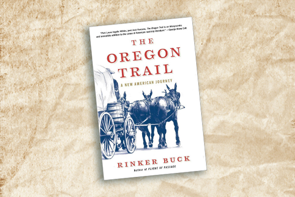
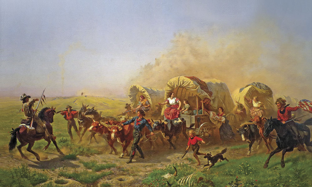
When the travelers loaded their wooden wheeled wagons and hitched oxen or mules to begin a nearly 2,000-mile journey from the Missouri River to Oregon Country in 1843, they could not envision that 175 years later their journeys would be legendary.
Ezra Meeker began a movement in 1906-07 to recognize the Oregon Trail when he drove his own wagon from Oregon to the east, placing markers where pioneers had trod. Fifty years ago, on October 2, 1968, President Lyndon B. Johnson signed the National Trails System Act into law, fulfilling a commitment first voiced in February 1965 when President Johnson noted, “The forgotten outdoorsmen of today are those who like to walk, hike, ride horseback, or bicycle. For them we must have trails as well as highways.”
The first trail to receive National Historic Trail status was the Oregon Trail in 1978. Only Congress can designate a National Historic Trail, and in 1992, legislators amended the National Trails System Act to designate the California National Trail. To date there are 19 National Historic Trails, plus another 11 National Scenic Trails and more than 1,200 National Recreation Trails in the National Trails System.
Currently, the National Park Service has recommended that 24 of the 74 historic trail routes that they are studying be added to the National Historic Trails system. Many of those routes are feeder roads for the Oregon Trail.
We celebrate both the 175th anniversary of the Oregon Trail and the golden anniversary of the National Trails System Act—a measure that has preserved an important piece of America’s legacy.
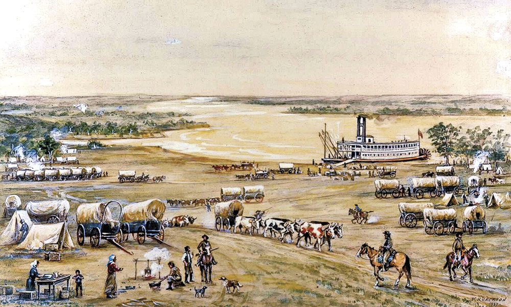
— Courtesy The Scotts Bluff National Monument, NPS.gov —
Missouri, Kansas & Nebraska
Missouri
The trail to Oregon Country begins at Courthouse Square in Independence, Missouri, but most of the 2,000-mile route followed trails used by American Indians, fur trappers and animals long before any wagon wheels rolled into the West. Missouri’s status as a jumping off place into the West actually started with Santa Fe Trail travel in the 1820s, but it was the desire by hundreds of thousands of people headed to Oregon and then California that cemented its status as the starting point for Western migration.
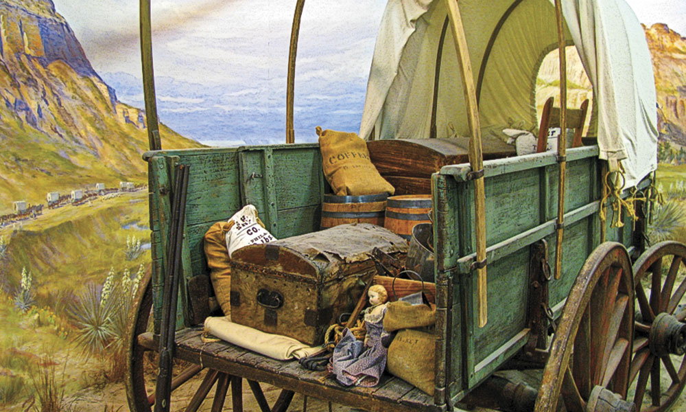
— Courtesy Gorilla Jones, Creative Commons —
[May 11, 1846] This is the placewhere emigrants usually rendezvous for the purpose of completing their purchases for the journey, and making their final preparations…. Merchants were doing all in their power to affect the sale of supplies to emigrants.
—J. Quinn Thornton, 1846
Independence is a flourishing frontier town. It contains a courthouse, churches, an Odd Fellow and Freemason’s Lodge, hotels, mechanics of different kinds, flouring mills (in the vicinity), and a number of good stores, and a full assortment of goods adapted to a journey across the mountains. The Santa Fe traders fit out here. The merchants are polite and obliging, and sell goods at reasonable rates. …Good large American mules domesticated and broken, are worth from $60 to $90; work oxen from $25 to $30 per yoke. Horses from $30 upwards.
—T.H. Jefferson, 1846
Independence Courthouse Square
Independence
This is the official start of the Oregon Trail, where wagons were outfitted through much of the emigration era.
Oregon-California Trails Association
Independence
Dedicated to preservation of the Oregon and California trails, the association headquarters are in Independence. OCTA holds an annual convention, regular symposiums on trail subjects, and publishes the Overland Journal. The 2018 convention will be in Ogden, Utah, August 6-10.
National Frontier Trails Museum
Independence
The first of many museums along the route of the Oregon Trail is dedicated to the story of the overland trails. The museum is home of the Merrill Mattes Research Library with rare books and manuscripts on trail subjects.
Westport Landing
Kansas City
Many emigrants arrived here on riverboats, but switched to wagons for their overland journeys. A walking/biking trail at this site offers views of the Missouri River.
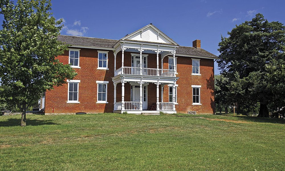
— Photo by Harold J. Schuster Courtesy Kansas Tourism —
Kansas
The trail west from Independence crosses the northeastern corner of Kansas, a landscape that rises and rolls as it is cut by large and small tributaries to the Missouri River. This section of trail was a transition point from the great river country into the Tallgrass Prairie lands.
The Nimehaw river [is] the most beautiful spot that ever I saw in my life I would like to live here. As far as the eye can reach either way lay grass and flowers meets the eye until you reach the valley of the river which is as level as the house floor.
—Lydia Allen Rudd, 1852
Moses Grinter House and Ferry
Kansas City
In 1831 Moses Grinter established a ferry service to transport emigrant wagons across the Kansas River. The Grinter house, made of home-kilned bricks, is the oldest home in Wyandotte County and has some items that belonged to the Grinter family, including quilt blocks Annie Grinter made, family photos, Bibles and furniture.
Alcove Spring
Blue Rapids
This site has been called the most significant historic site on the Oregon Trail within the state of Kansas. The scenic spring was a popular campsite and is now part of the Alcove Spring Historical Trust, a 300-acre park, where you will find a hiking trail, and emigrant inscriptions.
St. Marys Mission and Oregon Trail Nature Park
St. Marys
Jesuits established this Catholic mission to the Potawatomi Indians in 1848. Located between St. Marys and Belvue, the Oregon Trail Nature Park has nature trails and views of the historic trail route.
We traveled fifteen miles to Elm Grove, where we encamped for the night. …There are only two trees in this grove—both elms—and I have learned for the first time that two trees could
compose a grove.
– Peter H. Bennett, from a letter written to James G. Bennett, January 18, 1845.
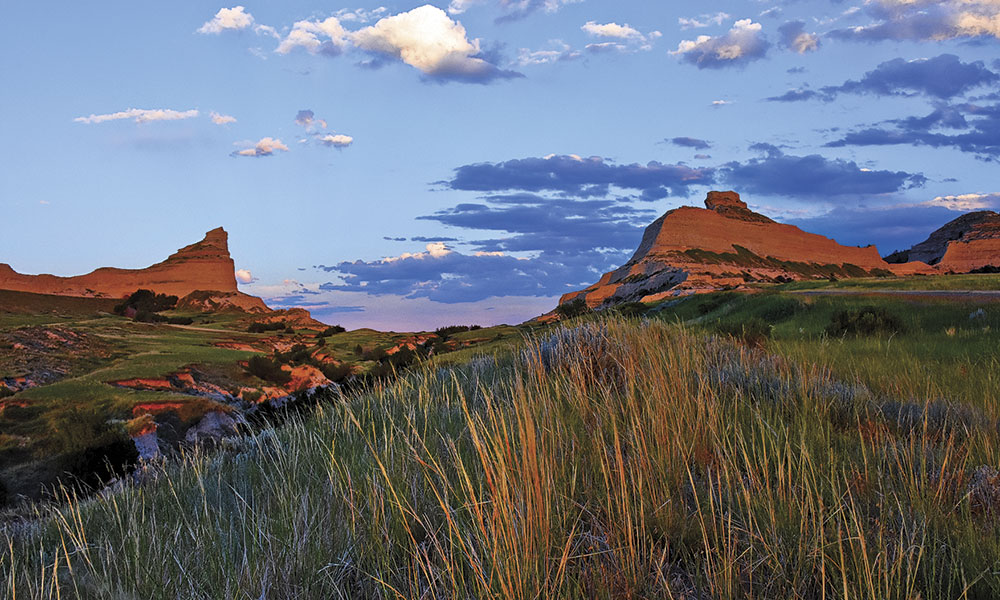
— Courtesy Anna Repp, Creative Commons —
Nebraska
When the Oregon Trail crossed into what is now Nebraska, the route began to change, along with the landscape. Following the Blue River, wagons headed north and west, ultimately striking the Platte to cut a path along the Great Platte River Road. The tallgrass prairie gave way to shortgrass prairie as the land flattened and the climate became more arid.
Rock Creek Station State Historical Park
Fairbury
This road ranch served travelers headed to Oregon and California, and later became a stage station and Pony Express station. Here visitors have a chance to walk beside deep swales carved when the wagons pulled up the hill away from the creek, and see pioneer graves, reconstructed buildings and receive historical information about Wild Bill Hickok killing three men at the station.
Fort Kearny State Historical Park
Kearney
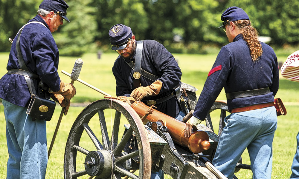
The first Western military post built to protect Oregon-bound emigrants, Fort Kearny became an important trail location, providing an opportunity for people to obtain a few supplies, and—most important to many—to write a letter and send it back home.
— Courtesy NPS.gov —
[May 28] The valley of the Platte is low and in places marshy, though the soil and subsoil is sandy. It never will be arable land. We passed Fort Kearny this day; it is the first western fort I have seen. It is on low land some half mile from the river. It consists of about twenty houses made of sod, some roofed with the same material, walls two feet thick. …Some of our men wrote home from this fort. It has a store and a blacksmith shop.
—John Banks, 1849
The Great Platte River Road Archway
Kearney
The archway spans Interstate-80, but as you ascend the escalator and then cross the archway, you step back in time, taking a virtual trip on the trail to the West.
Windlass Hill & Ash Hollow State Historical Park
Lewellen
You’ll see an impressive set of trail ruts as they descend Windlass Hill toward Ash Hollow. The areas—more than 1,000 acres—have walking trails, a visitor center and a pioneer grave.
Chimney Rock National Historic Site
Bayard
Pioneers called this area the Valley of Monuments, and Chimney Rock became the most recognized, and written about, location in Nebraska.
[Friday, June 19] Passed the chimney in the fore part of the day and the formation of the bluffs have a tendency to fill the mind with awe and grandeur. The chimney might pass for one of the foundries in St. Louis, were it blackened by burning stone coal.
—Virgil Pringle, 1846
Scotts Bluff National Monument
Gering
Larger than Chimney Rock, Scotts Bluff is also visible for miles (for the pioneers it was for days). The view from the top of the bluff is surpassed only by the collection of trail paintings by William Henry Jackson. New exhibits are planned for the visitors’ center. From here you can get directions to Roubidoux Pass National Historic Landmark and Trading Post.
Legacy of the Plains Museum
Gering
The great trail collection of diaries, journals, letters and maps assembled by Helen and Paul Henderson is held by this museum, making it a prime place for some in-depth research about the trail.
— Candy Moulton —
Wyoming and Idaho
Wyoming
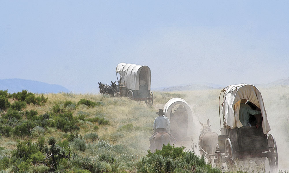
Robert Stuart’s tough little band of trappers located the great South Pass of the Rockies in 1812, but it would be 14 years before the first wagon crossed the area, and four decades before wagon travel began in earnest. In Wyoming, the trails are inextricably linked with the fur traders and trappers. Mountain men Jedediah Smith, James Clyman and Thomas Fitzpatrick, crossed through the gap of South Pass in 1824.
A fur trade caravan in 1836 included missionary wives Narcissa Whitman and Eliza Spalding, proving that women could travel the trail. The family of Joel and Mary Walker, including four children, traveled the route to Oregon in 1840, again affirming that crossing the continent could be managed even by the youngest of adventurers.
Fort Laramie National Historic Site
Fort Laramie
When the Bidwell-Bartleson wagon train traveled West in 1841, they found a small fur trade post, known as Fort John, near the North Platte River. This location became key to emigration. Renamed Fort Laramie, it became a military post in 1849, situated and garrisoned to protect travelers on the great overland road.
Register Cliff State Historic Site and Oregon Trail Ruts State Historic Site
Guernsey
Emigrants carved their names into the face of Register Cliff, and just a couple of miles farther west, wagon wheels gouged deep ruts into sandstone, where wagons were forced to traverse a rock outcrop to avoid marshy areas along the North Platte River.
Independence Rock State Historic Site
West of Alcova
This is the most-noted landmark of the wagon trails west of Fort Laramie. Thousands of emigrants camped here and many either painted or carved their names in the granite. You can climb the rock or hike around its base.
Next came to Independence Rock, it stands alone in the valley of Sweet Water, entirely separated from other Mountains. It is composed of granite & is about 500 ft. long 200 broad and about 250 ft. high. There are thousands of names on it, nearly all who pass leave their names. It is certainly one of Nature’s most magnificent structures and is fitly named Independence Rock as it is independent of all others in the vicinity.
—Esther Belle Hanna, 1852
July 2: We started on our way at 7 a. m., came…to the “Devil’s Gate,” which is something grand—perpendicular rocks of granite formation touring [towering] up 400 feet high on either side of the river, and the Sweetwater running between, having cut its way through this granite formation for about 1,000 feet in length, and about 130 feet in breadth.
—Enoch W. Conyers, 1852
Devil’s Gate
West of Independence Rock, Natrona County
This deep cleft cut through a rock ridge by the Sweetwater River, is located near the Mormon Trail Handcart Historic Site & Visitor Center, and a replica of Fort Seminoe.
South Pass
Fremont and Sweetwater Counties
This gap in the Rocky Mountains is the reason some 500,000 travelers took this route to Oregon, California and Utah on 19th-century trails. The scars left by the wagons and the horses, mules, and oxen that pulled them are still visible. The crossing of South Pass marked not just a change from the Atlantic to the Pacific watersheds, but also placed travelers in Oregon Country—though they still had hundreds of miles to go before their journey ended.
Fort Bridger State Historic Park Fort
Bridger
Built by Jim Bridger and Louis Vasquez “in the road of the emigrants on the Black Fork of the Green River,” Fort Bridger served mountain men, Indian traders, Oregon and California emigrants, Mormon pioneers and militiamen, the 49ers, Pony Express riders, stagecoach drivers, U.S. soldiers and railroaders. A replica of Bridger’s post is one of the many structures at the fort, which every Labor Day weekend hosts the largest mountain man rendezvous re-enactment in the West.
— Peg Owens, Courtesy Idaho Tourism —
Idaho
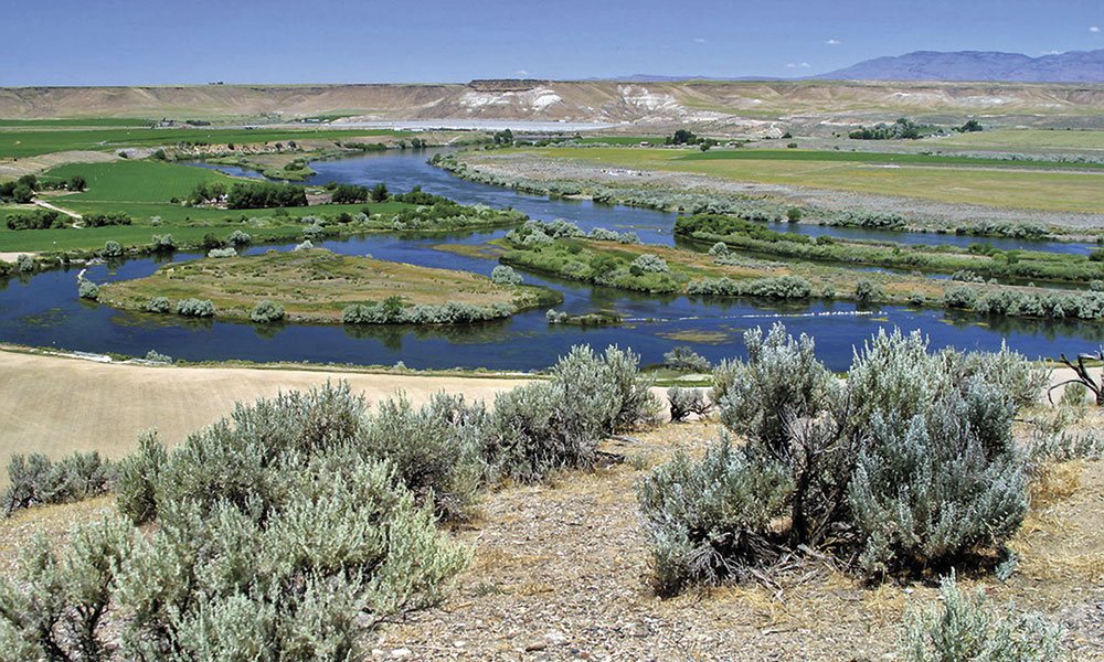
The pioneers’ entrance to what is today’s Idaho involved a meander along the Bear River before they needed to ascend—and then descend—a steep hill that quickly earned the name “Big Hill.” For most of the journey across Idaho, the wagon pioneers followed the Snake River, marveling at its width and noting awe-inspiring waterfalls. They traveled this section of the trail in late summer, broiling under the sun, seeing few trees, wondering if the trail would ever end.
Tuesday [July] 13: This morning we began to ascend the mountains again, they were very steep [Big Hill] yet the road was smooth with the exception of one in the decent, it was very rocky; we got over safely and came into the valley of Bear River again. We had a most delightful view of this valley & the meanderings of the river for miles & miles from the mountains.
—Esther Belle Hanna, 1852
National California-Oregon Trail Interpretive Center
Montpelier
The campsite pioneers used on the west side of Big Hill is the location of this interpretive center.
Fort Hall Replica
Pocatello
The replica of Fort Hall interprets the history of the fur trade, and the earliest travelers on the Oregon Trail. The original Fort Hall was located farther north on land that is now a part of the Shoshone-Bannock Indian Reservation.
Three Island Crossing State Park
Glenns Ferry
Wagons forded the Snake River by leap-frogging across the three islands in the river that are a signature of this park.
— Candy Moulton —
Oregon and Washington
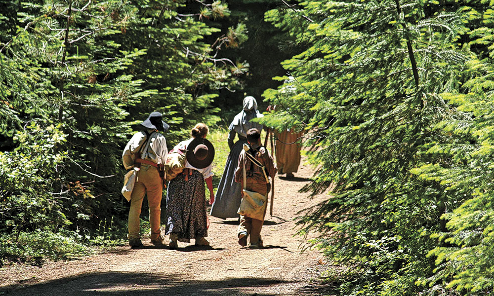
The timber had to be cut [in the Blue Mountains] and removed to make way for the wagons. The trees were cut just near enough to the ground to allow the wagons to pass over the stumps and the road through the forest was only cleared out wide enough for a wagon to pass along…. In passing across the mountains we were overtaken by a snow storm which
made the prospect very dismal.
—Jesse Applegate, 1843
Here [at The Dalles] was the end of our road, as no wagons had ever gone below this place. We found some sixty families in waiting for a passage down the river; and … but two small boats running to the Cascade falls….
—Joel Palmer, 1845
The long journey along the Snake River finally came to an end at Farewell Bend, although the pioneers had been in Oregon Country for weeks, and hundreds of miles, ever since they crossed South Pass. In today’s Oregon they found the traveling conditions more interesting, and also more challenging as they began their ascent of the Blue Mountains. They would soon reach the Columbia River, and follow it as far as they could before they either abandoned wagons and made rafts to continue downriver, or struck out over even more rugged mountains, The Cascades, before reaching their ultimate destination—the Willamette Valley.
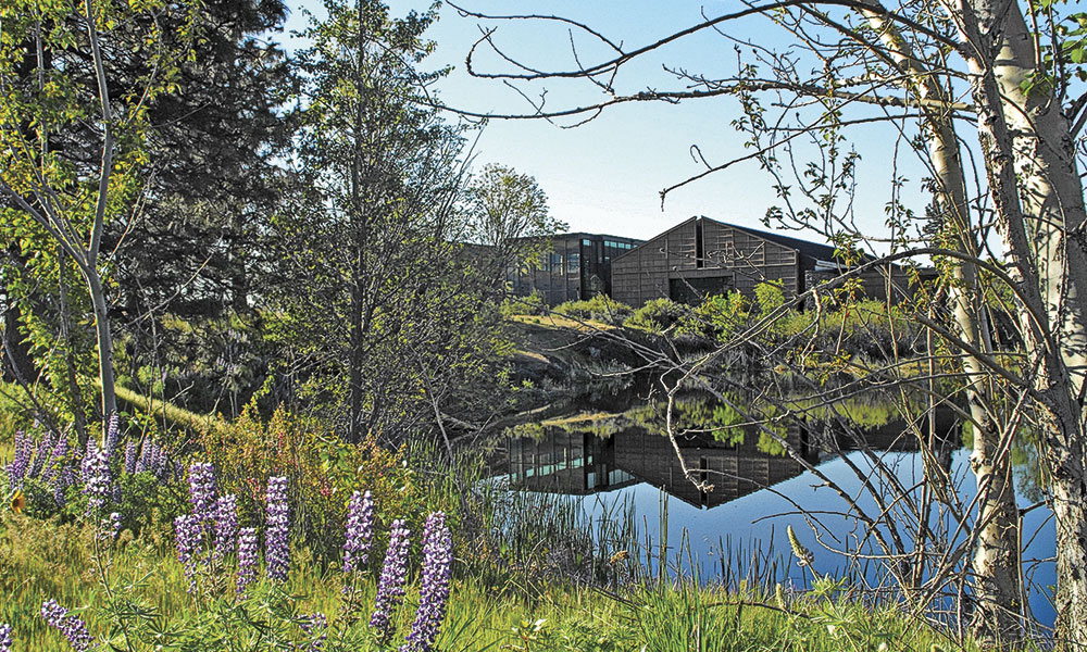
— Courtesy Columbia Gorge Discovery Center —
Oregon
National Historic Oregon Trail Interpretive Center
Baker City
Located on Flagstaff Hill, you can see the trail as it winds across the sagebrush-covered hills. The center, one of the first built to interpret Oregon Trail history, is an immersive experience into the lives of travelers. A wagon circle gives a good view of the trail ruts.
The Dalles
The Dalles
The overland journey for those traveling on the Oregon Trail in its earliest years ended at The Dalles. That is because here the river encroached so closely on the steep walls of the Columbia Gorge that it was impossible for -wagons to travel beside it. As a result, the travelers abandoned their wagons, built rafts, and continued down the river road to Fort Vancouver.
End of the Oregon Trail Interpretive Center
Oregon City
The Oregon Trail ended at many places in the Pacific Northwest in both Oregon and Washington, which were all Oregon Territory at the time of the pioneer migration. By far the majority of early travelers on the trail were headed to the Willamette Valley, where they would ultimately settle in Oregon City and other surrounding areas, building up communities, a territory and eventually a state.
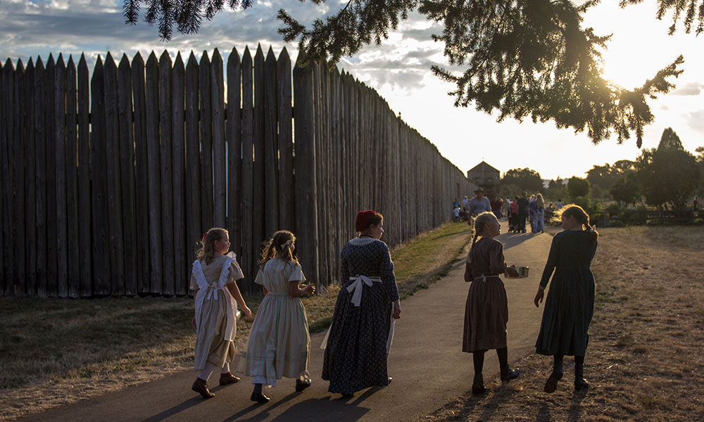
— Courtesy NPS.gov —
Washington
Whitman Mission National Historic Site
Walla Walla
Missionary doctor Marcus Whitman and his wife, Narcissa, one of the first two white women to travel the Oregon Trail, established this mission, working among the Cayuse Indians, who called the general area Wy-eé-lat-poo, “the place of the rye grass,” spelled Waiilatpu by Dr. Whitman.
Fort Vancouver National Historic Site
Vancouver
When Oregon-bound travelers finally reached the end of their overland and river journey, they found aid at the Hudson’s Bay Fur Company post, Fort Vancouver, which had supplies so desperately needed by people who had been on the trail for months. Chief Factor Dr. John McLoughlin managed the post. You can visit his home in Oregon City.
In 1993 Candy Moulton traveled with the Oregon Trail Wagon Train that departed Independence, Missouri, in May and reached Independence, Oregon, in October. She and wagon driver Ben Kern subsequently wrote Wagon Wheels: A Contemporary Journey on the Oregon Trail. Ben passed on this year, along with his and Candy’s good friend Jere Krakow, a dedicated public servant and trail steward. No two men more loved the trail than Ben and Jere.

