The American West’s awe-inspiring vistas—the seemingly endless prairies of the Great Plains, the great wall of snowcapped granite peaks of the Rocky Mountains, the shimmering desert mirages that dance along the Great Basin’s horizon and the seemingly impenetrable Western forests—emboldened a century of explorers, entrepreneurs, nation-builders and settlers to carve out roughhewn trails across a continent.
Men and women built those tracks, roads and rails with purpose and hope, determination and desire, wealth and independence. As the road builders blazed new routes of opportunity, enterprising settlers built boomtowns along the rutted highways as trading posts, ferry crossings and railheads. New trails were carved deeper into the mountains and valleys, and across the plains and deserts, to mine and ship the natural resources of the West to fuel America’s Manifest Destiny and industrial revolution. Along the way, many of those Western towns busted and today are only windswept ghosts along a blue highway. But, for every lost bonanza, a historic town along a heritage trail thrives today.
So, pack your bags and follow your dreams to a true Western town and celebrate the spirit of independence that built a nation.
The Overland Trail: Independence, Missouri to Scottsbluff/Gering, Nebraska
Via I-29, U.S. 36/I-80/U.S. 26; 650 miles 11 hours. Inside Tip: Exit the I-80 at Grand Island and enjoy the slow roll through history on U.S. 30 “The Lincoln Highway” to U.S. 26 turnoff to Scottsbluff/Gering.
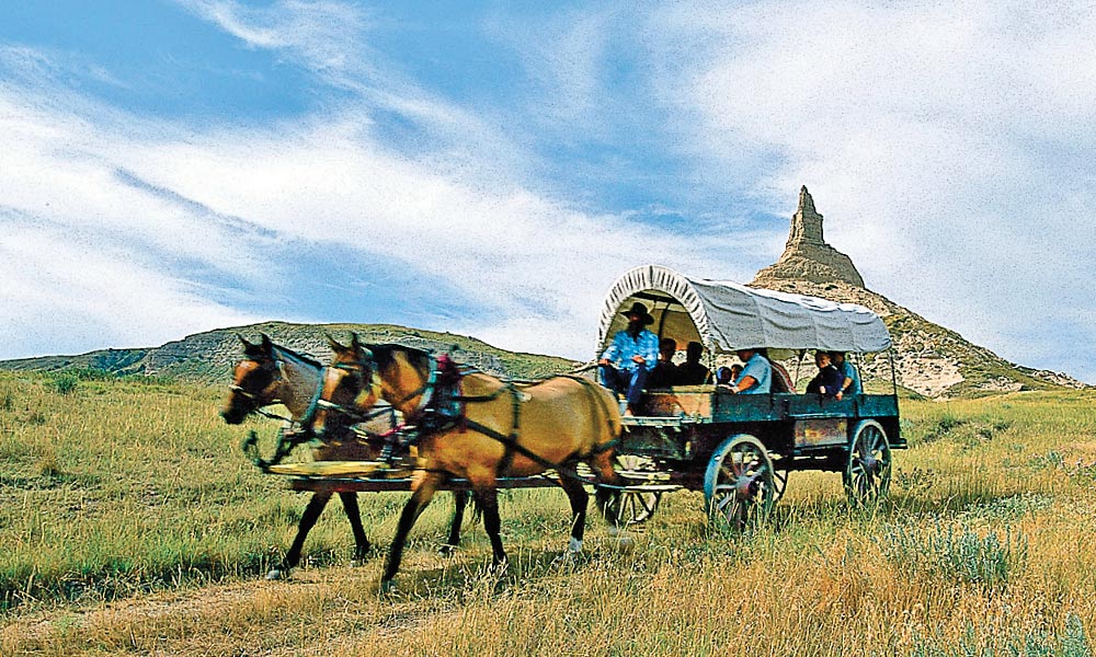
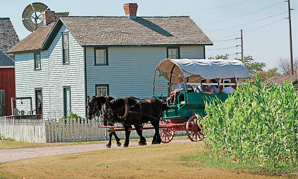
Today, the famous Platte River route of the Overland Trail from Missouri to Nebraska is a spectacular road trip across prairie and plains. Beginning in Independence, Missouri, the National Frontier Trails Museum’s extensive collections is an ideal place to start a Western trails adventure. A few miles away in Westport is the Westport Historical Society in the Harris Kearney House, which provides great insights into why the trailhead moved downriver from Independence to Westport Landing in the late 1840s.
– Courtesy Fort Caspar Museum –
After a jaunt across the northeastern corner of Kansas, a great introduction to Oregon Trail and Pony Express history in the Cornhusker state is Rock Creek Station State Historic Park near Fairbury. Next stop is Grand Island’s The Stuhr Museum of the Prairie Pioneer and a tour of its living history center. Less than an hour west are Fort Kearny State Historical Park, the Trails and Rails Museum and the dramatic Great Platte River Road Archway Monument in Kearney. All expertly interpret different facets of frontier Nebraska. On the way to North Platte and the Buffalo Bill Ranch State Historical Park, exit in Cozad to visit the 100th
Meridian Museum and the Sod House Museum in Gothenburg. From North Platte, enjoy the scenic U.S. 30/26, along the North Platte River to Scottsbluff/Gering for a tour of Chimney Rock National Historic Site, Scotts Bluff National Monument and Legacy of the Plains Museum.
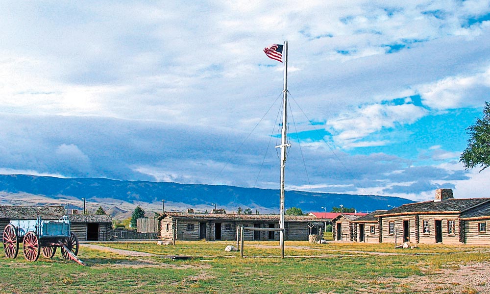
Wyoming’s Pony Express Trail: Fort Laramie to Fort Bridger, Wyoming
Via U.S. 26/I-25/S.R. 220/U.S. 287/SR 28/US 191/I-80; 500 miles, 9 hours. Inside Tip: Keep an eye on the weather when driving on Wyoming’s back roads.
Fort Laramie National Historic Site is the first major stop when following the trail of the Pony Express across the state east to West. The legendary service only lasted from April 1860 to October 1861 and riders rode ten days door to door from Sacramento, California, to St. Joseph, Missouri. Traveling West to Douglas, a visit to the Pioneer Museum and Fort Fetterman Historic Site are well worth the time before traveling westward to Casper and the Platte Bridge Station at Fort Caspar Museum.
From Casper, Wyoming’s Pony Express Trail will take the intrepid traveler south by southwest past Emigrant Gap, Independence Rock State Historic Site, Devil’s Gate, Sweetwater Station, South Pass City State Historic Site, Sweetwater Historic Museum in Green River and to Fort Bridger State Historic Site. Visitors can walk along the Oregon Trail and the Pony Express route at Fort Bridger, tour the restored Pony Express barn, enjoy regular living history demonstrations, and, from May to September, visit a replica of Jim Bridger’s Trading Post.
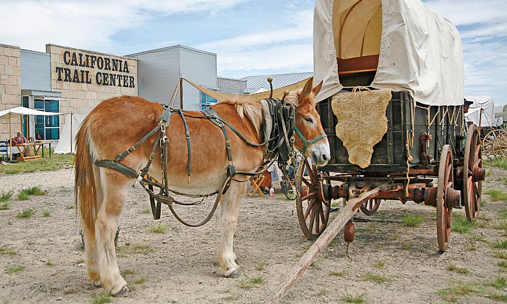
California’s Bonanza Trail: Elko, Nevada to Sacramento, California
Via I-80/U.S. 395/U.S.50; 632 Miles, 12 Hours. Inside Tip: Exit I-80 at Reno, south on U.S. 395 to U.S. 50 “The Lincoln Highway” for a scenic drive through the Sierras.
The California Trail across northern Nevada would be considered nearly as lonely a highway as its southern neighbor U.S. 50 but for the fact that the transcontinental trail and its consistent sources of water made it the favored route for the Central Pacific Railroad and later U.S. 40 and Interstate 80. Elko, the unofficial capital of northern Nevada, is the perfect place to stay a couple days and explore the pioneer history of the region at the California Trail Interpretive Center and the Western Folklife Center.
– Courtesy TravelNevada –
From Elko, the California Trail aficionado can explore for a few days or a week the heritage of northern Nevada, the Reno/Carson City/Lake Tahoe region, the gold country of the Sierras along U.S. 50, through the foothills and into Sacramento. The Marshall Gold Discovery State Historic Park in Caloma, north of Placerville, is one of the finest living history museums in the state. After
a slow-roll through gold country, visit Sacramento’s museum complex akin to the Smithsonian: the State Capitol Museum, the California State Railroad Museum and four State Historic Parks: Sutter’s Fort, Old Sacramento, Leland Stanford Mansion and the Governor’s Mansion. After all that history, relax, reflect and enjoy a meal at the Almost Famous River City Saloon in the Old Sacramento Historic District.
The Oregon Trail to the Promised Land: Baker City to Oregon City, Oregon
Via I-84/U.S. 197/S.R. 216/U.S. 26; 350 Miles, 6 Hours. Inside Tip: Adventurous travelers can also take the Barlow Trail route around the southern flank of Mount Hood from The Dalles south and West via U.S. 197/ S.R. 216/U.S. 26.
Emigrants on the Oregon Trail had traveled nearly 1,900 miles when they arrived at Baker City, Oregon, just west of the Snake River crossing at Farewell Bend. Nearly 300,000 would trek the trail’s length to the Willamette Valley. The guides at the Oregon Trail Interpretive Center near Baker City will explain in detail the state of mind the settlers were in after surviving the last 300 miles across Idaho.
From Baker City the highway winds north to Pendleton and West along the Columbia River Valley to The Dalles, the last stop for the pioneers before plunging down the river’s cascades. The Columbia Gorge Discovery Center & Museum exhibitions expertly tell the story of the land, peoples and settlement of Oregon. especially at the important crossroads of Indian peoples who fished near the city for centuries before the river was tamed for hydroelectricity and flood control.
Before the Barlow Wagon Road was built on the south side of Mount Hood to Oregon City in 1846, emigrants had to brave the Columbia’s dangerous currents. Nonetheless, the 100 miles of track away from the Gorge and over the Cascade Range to the Willamette Valley tested the nerves and strength of the weary wagons, animals and settlers. Today, the docents at the John McLoughlin House National Historic Site in Oregon City will greet you in period dress and congratulate you on your own heroic journey across the Oregon Trail.
Lewis and Clark Across Montana: Williston, North Dakota, to Lolo Pass, Montana
Via U.S. 2/I-15/I-90/U.S. 93; 685 miles, 11 Hours. Inside Tip: Southwest Montana Loop, take S.R. 2 from Butte to S.R. 41 South and follow the Lewis and Clark Trail to Lolo and Missoula for a spectacular, scenic heritage adventure.
A tour of the Fort Union Trading Post National Historic Site on the border of North Dakota and Montana near Williston, North Dakota, at the confluence of the Yellowstone and Missouri rivers is an ideal place to begin tracing Lewis and Clark’s journey across the Big Sky state. The Corps of Discovery had encamped in November 1804 for the winter wintered in the Mandan Villages east of the fort before they continued West in April 1805.
– Courtesy Donnie Sexton, Visit Montana/“Lewis and Clark at Three Forks,” Montana State Capitol, Wikimedia Commons –
Highway 2 parallel’s the river route of the expedition across the Missouri Breaks country of northeastern Montana to U.S. Highway 87 south along the Missouri River Valley to Historic Old Fort Benton. The road continues to Great Falls for a walking tour of Giant Springs State Park and a visit to the C.M. Russell Museum.
From Great Falls the highway leads to the wild and mountainous southwestern Montana, where Lewis and Clark’s Corps almost starved in the Bitterroots while trying to cross the range into Idaho. The Lewis and Clark Trail on S.R. 41 leads past the key landmark at Beaverhead Rock State Park that the Corps reached on August 8, 1805. Staying on the marked trail on S.R. 278 west from Dillon, the historic route will go past the Big Hole National Battlefield Site to U.S. north through the Bitterroot National Forest to Travelers Rest State Park near Lolo and Missoula. A wonderful way to conclude such a spectacular Lewis and Clark auto tour is at the Montana Natural History Center in honor of the Corps’ notes on 122 animals unknown to science at the time that they encountered.
The Santa Fe Trail: Independence, Missouri, to Santa Fe, New Mexico
Via La Junta, Colorado, I-70/SR 156/U.S. 150/I-25; 827 miles, 13 hours. Inside Tip: Fort Union National Monument east of Las Vegas, N.M. on I-25 is the crossroads of the two routes of the Santa Fe Trail.
Following the Santa Fe Trail after touring the National Frontier Trails Museum in Independence, Missouri, the urban oasis of Kansas City gives way to the Flint Hills of Kansas and the endless horizon of the Great Plains. The Santa Fe Trail Association’s interactive map at SantaFeTrail.org is the perfect guide to every historic step across the Sunflower State, including a visit to Fort Larned State Historic Site on U.S. Highway 56 between Great Bend and historic Fort Dodge, built in 1864.
Another must stop is the Boot Hill Museum in Dodge City. Just nine miles west of the city on U.S. Highway 50/400 is a stretch of the trail on the National Register of Historic Places maintained owned and maintained by the museum. From Dodge City, the trail splits either southwest via the Cimarron Cut-off, or the route with more reliable water but more difficult mountain trails south of Bent’s Fort near the Arkansas River adjacent to modern La Junta, Colorado.
For the history lover, a detour to Bent’s Fort National Historic Site is akin to visiting the Williamsburg of the Plains. A remarkable living history center immerses the visitor in Santa Fe Trail history better than any other location between Independence and Santa Fe. Don’t miss the Bent Brothers game room that features a billiard table brought overland to provide entertainment on the edge of nowhere. Once in Santa Fe, walk the historic streets to the city plaza and a tour of the Palace of the Governors.
The Butterfield Southern Overland Trail: Abilene to El Paso, Texas
Via U.S. 277/U.S 67-U.S. 385/I-10/S.R. 118S-S.R. 175/U.S. 90/I-10; 635 miles, 10.5 hours. Inside Tip: From Alpine go south on S.R.18 for a scenic loop trip to Big Bend National Park.
A dozen years after entering the Union, the Butterfield Southern Overland Trail connected the youthful Lone Star state with San Francisco, California in the West to St. Louis, Missouri, in the east. The semiweekly mail and stage route ran 2,795 miles and is most likely the longest horse-drawn transportation system in the nation’s history. Congress authorized the mail service on March 3, 1857 and the contract was awarded to John Butterfield and company. The bid earned the stage and mail service $600,000 a year-plus income from express and passengers.
– Courtesy GregsTexas/Wikimedia Commons –
Today, speeding across West Texas on an interstate gets you to El Paso from Abilene in a day, but what is the fun in that if you could actually take your time and follow the Southern Butterfield Trail from Fort Phantom Hill, site of a stage stop, just east of Abilene on a coach, cavalry and cattle tour of West Texas that in 2016 will also include the bonus of the sesquicentennial of the Buffalo Soldiers, who were posted to many of the army camps in southwestern Texas after the Civil War.
After touring downtown Abilene’s premier Western museum, Frontier Texas!, travel south on the Texas Forts Trail to Fort Chadbourne, Fort Stockton and Fort Davis National Historic Park (via Alpine). The direct route of the stage line is difficult to follow from Fort Davis, one of the most important military posts along the final leg of the original 458 mile route between Fort Phantom Hill and El Paso (still known as Franklin when the stageline ran before the Civil War), but the scenic route from Marfa to Van Horn on U.S. 90 before taking I-10 to exit 78 and the slower but more historic highway into El Paso past numerous stage stops along the Rio Grande including the historic community of San Elizario.
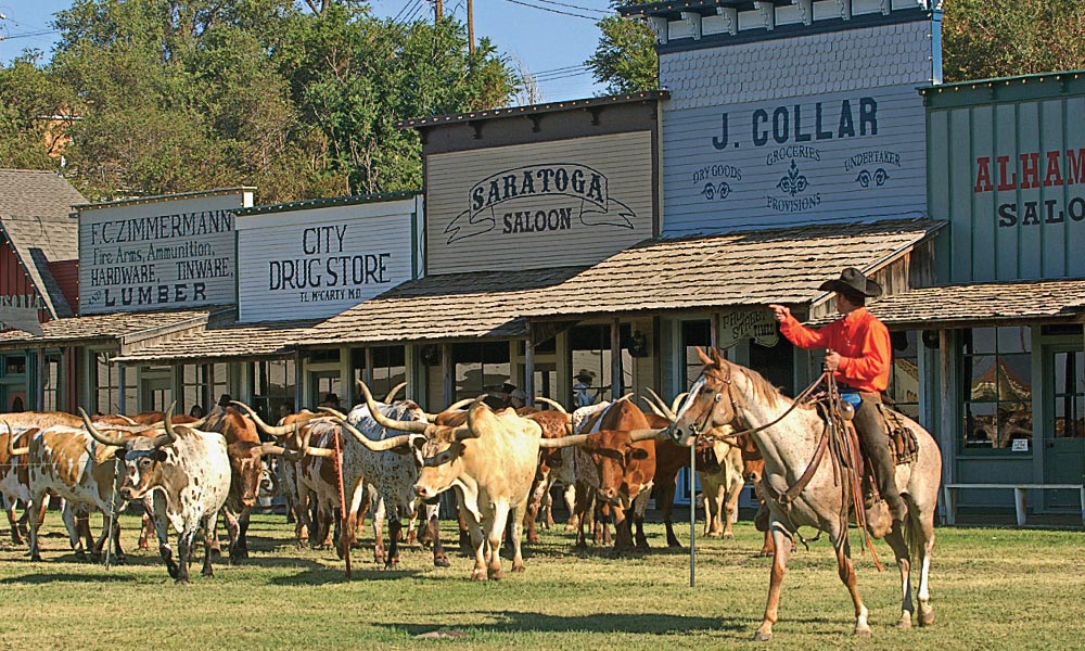
On the Trail to Kansas’s Cattle Towns: Abilene to Dodge City, Kansas
Via I-70/S.R. 156/S.R. 140-141-4/I-135/U.S. 400; 335 miles, 5.5 hours. Inside Tip: Look for historical markers across the state that celebrate the overlapping history of the Santa Fe Trail, Chisholm Trail cow towns and Santa Fe Railroad.
– Photo by Max McCoy –
A century and a half ago, Texas Jesse Chisholm had a dream: drive his cattle from Texas to a Kansas railroad town, make a profit, go back to Texas and do it again. In 2017, the International Chisholm Trail Association has planned a year-long celebration with numerous events in the historic cattle towns of Abilene, Durham, Wichita, Clearwater, Wellington and Caldwell.
Old Abilene Town celebrates its status as the first Kansas cow town on Chisholm Trail history of Old Abilene Town, where Wild Bill Hickok cemented his fame as a lawman before his infamous days in Deadwood. From Abilene take a slow roll southeast along the historic Chisholm Trail to tour the historic sites and museums dedicated to the history of the cowboys, cattle and railroads that forever etched the legend of the Old West into the history books of the Sunflower state.
– Photo by Max McCoy –
From Wichita, go west to the wickedest town on the Kansas plains, Dodge City, which was the terminus of the Great Western Trail, a branch off the Chisholm Trail. The Boot Hill Museum is the first place to start in Dodge City with a tour of its great exhibitions on the history of the frontier town, including a recreation of
the infamous Front Street. After Boot
Hill, take a walk downtown on the Dodge City Trail of Fame, with beautiful bronze statues dedicated to Wyatt Earp and Doc Holliday. The Gunfighters Wax Museum is old-fashioned fun, while a tour of the museum at Old Fort Dodge (the Kansas Soldiers Home) is well worth it.
Arizona’s Santa Fe Line: Holbrook to Kingman, Arizona
Via I-40/AZ/Historic Route 66; 255 miles,
4 hours. Inside Tip: While following the historic Santa Fe line get your kicks on Historic Route 66, with the longest stretch from Exit 139 to Kingman via the famous Ox-bow from Seligman to Kingman.
Holbrook was such a wild railroad town it didn’t have a church until 1914. Just West of Petrified National Park and the Painted Desert, Holbrook celebrates its Wild West past every July with its Annual Wild West Days & Bucket of Blood Races, July 16, 2016. Next stop is Winslow’s Santa Fe train station and architect Mary Jane Colter’s Spanish revival, 1929 hotel, La Posada. Used as railroad offices for years, it has been lovingly restored and is an architectural gem of Arizona’s old Santa Fe line.
– Courtesy Grand Canyon West –
West across the state, the landmark San Francisco Peaks beckon visitors as they cross the high desert to Flagstaff, which was named after a famous flagpole put
up on the Fourth of July, 1876. The Museum of Northern Arizona just west of the city is an essential stop for any traveler, after a visit to the active rail station and walking tour of the historic district, including a stretch of Old Route 66.
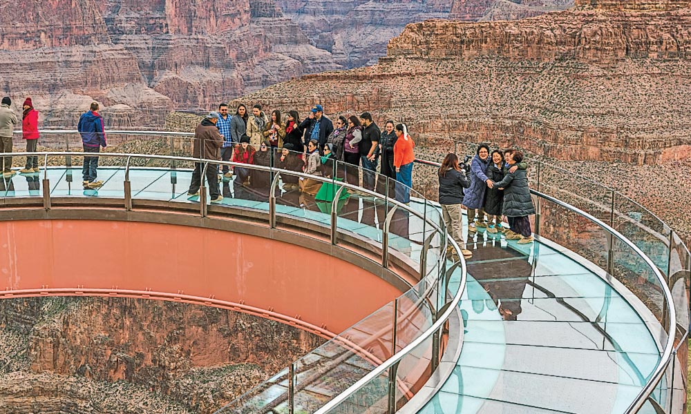
From Flagstaff west, I-40 speeds travelers and tourists to Williams, home of the Grand Canyon Railway and the historic Santa Fe Depot. From Williams, the interstate traffic rapidly moves across the state to historic Kingman and the Mohave Museum of History and Art, but slow down and get your kicks along the old Santa Fe line (today it is the Burlington Northern Santa Fe Railway) by driving historic Route 66 in search of Old West history through Seligman, Peach Springs, Truxton, Valentine and Hackberry. Take an extra day and tour the Hualapai Tribe’s Grand Canyon West where you can spend the night in cabin right on the rim of the canyon.
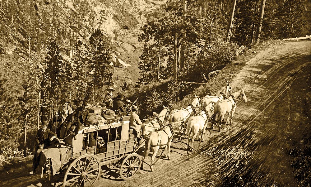
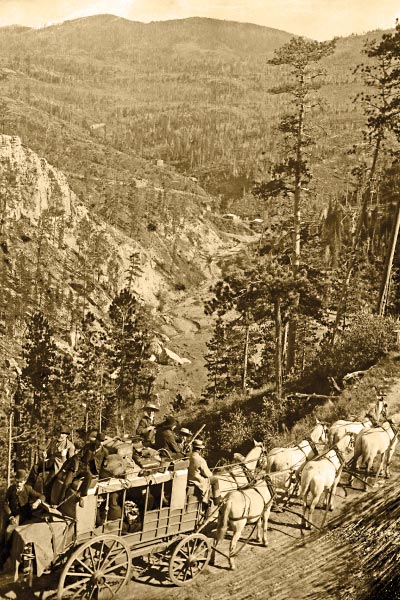
The Black Hills Stage Line: Cheyenne, Wyoming, to Deadwood, South Dakota
Via U.S. 85/U.S. 18/I-90/U.S. 85/U.S. 14A; 311 Miles, 5.5 hours. Inside Tip: Scenic route from Newcastle U.S. 16 to Custer and take U.S. 385/U.S. 16 North to Lead and Deadwood.
Almost 400 miles from Cheyenne the famous Deadwood stage is on display
at the Buffalo Bill Center of the West Museum complex in Cody. The famous coach that came around the Horn and was driven thousands of miles in California before being brought to the Dakota and Wyoming territories was saved in perpetuity by none other than William F. “Buffalo Bill” Cody himself, who used the stage in his Wild West show for many years.
– Wikimedia Commons/Charles C. Pierce/California Historical Society Collection at the University of Southern California –
Officially known as the Cheyenne and Blackhills Stage and Express Line, the stage line ran first September 25, 1876 and ran regularly, despite Indian attacks and hold ups, until February 19, 1887, when the arrival of the Fremont, Elkhorn, and Missouri Valley Railroad in nearby Rapid City made it obsolete. Two years later the tracks were built to Deadwood, but the legend of the famous Deadwood stage would live forever.
Traveling and tracking the old stage route from Cheyenne to Deadwood is as scenic journey into the Black Hills. From Cheyenne drive north parallel to the Wyoming-Nebraska-South Dakota line through Fort Laramie, Lusk, and Newcastle. Continue north to I-90 east to Spearfish and the Spearfish Scenic Highway to downtown historic Deadwood.
Stuart Rosebrook, True West’s senior editor, believes a road trip across the American West is good for the mind
and soul.
Related Articles
-
If a student of the exploration and expansion of the American West were to have…
-
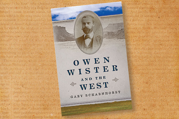
Gary Scharnhorst’s Owen Wister and the West is the most in-depth biography of this Eastern-bred…
-
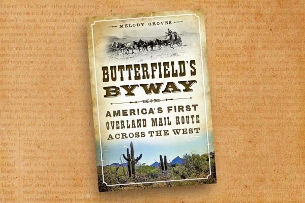
“Remember boys, nothing on God’s earth must stop the United States Mail,” John Butterfield admonished…